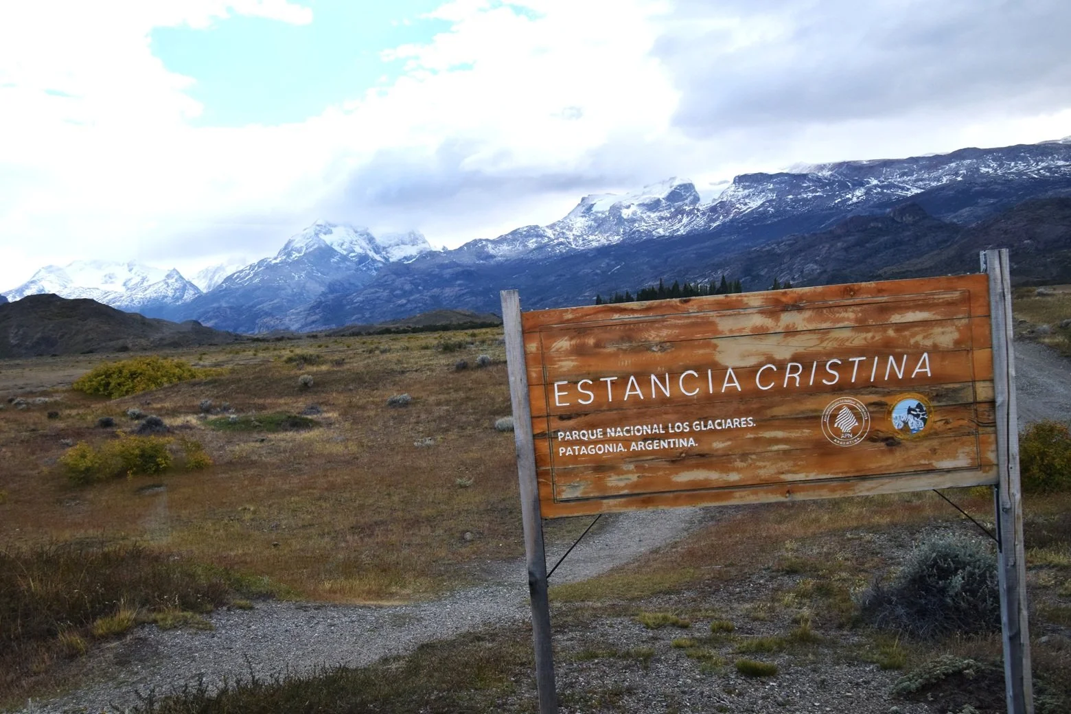
I thought I understood isolation until I went to Estancia Cristina
I went to Estancia Cristina, a sheep ranch in the back of Patagonia. I learned about Herbert Masters, a man born in the area and who spent most of his 82 years on that isolated ranch surrounded by sheep and mountains of ice.
I was already in El Calafate, which is remote enough: a three-hour flight from Buenos Aires, a small town on Lago Argentino, a lake cut by glaciers near the bottom of the continent. A southern cousin of Alaska.
From there we took a bus for an hour to a dock that is still not a town, and a boat for three hours to the Cristina shore. Huge chunks of a glacier floated in the water as we went by. The wind remained strong and cold against a bright blue sky. Strong wind off glacial ice swept away the warmth the bright sunlight tried to offer.
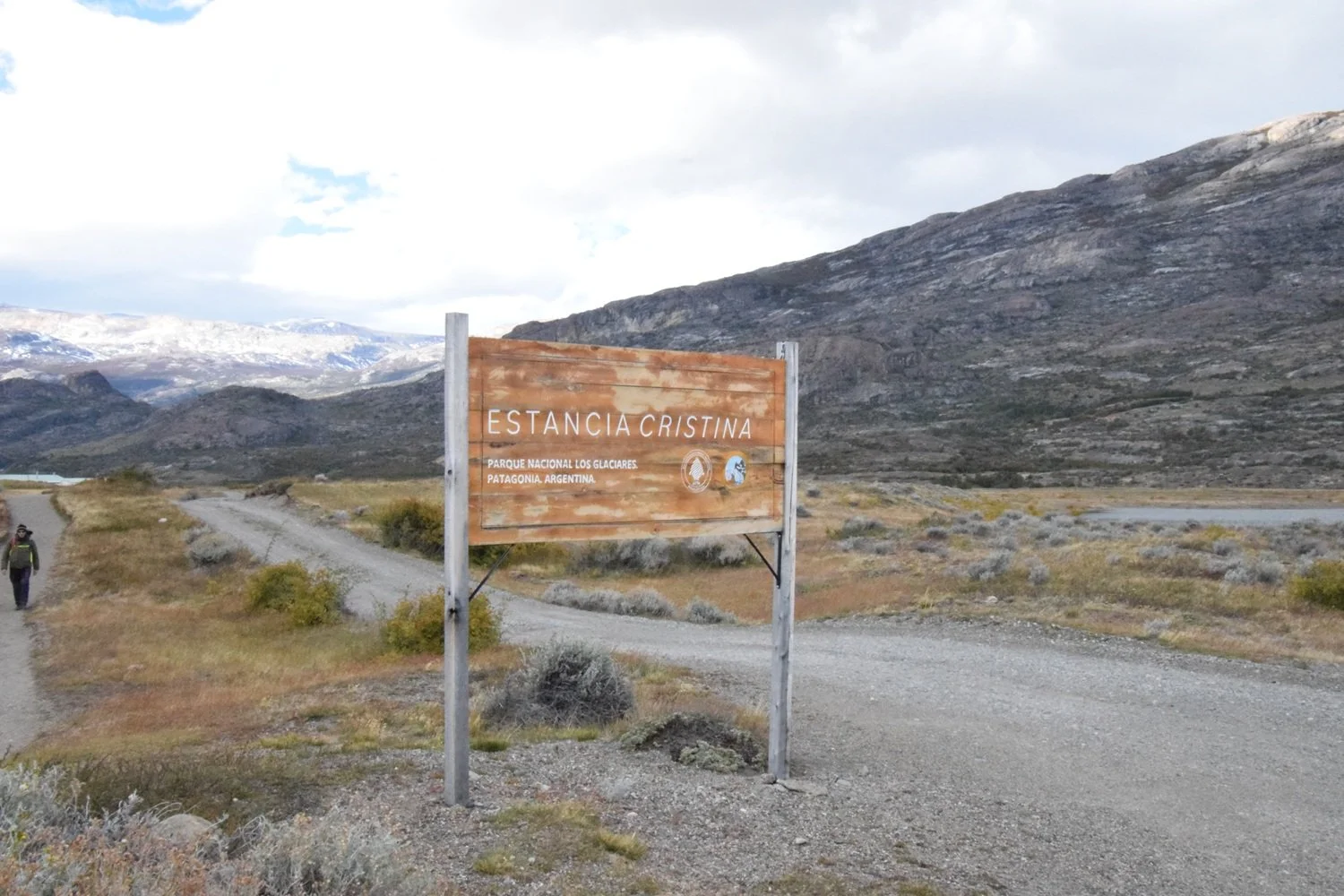
The entrance to the ranch Photos by James Jordan
The story of Herbert Masters showed me what it really means.
I went to Estancia Cristina, a sheep ranch in the back of Patagonia. I learned about Herbert Masters, a man born in the area and who spent most of his 82 years on that isolated ranch surrounded by sheep and mountains of ice.
I was already in El Calafate, which is remote enough: a three-hour flight from Buenos Aires, a small town on Lago Argentino, a lake cut by glaciers near the bottom of the continent. A southern cousin of Alaska.
From there we took a bus for an hour to a dock that is still not a town, and a boat for three hours to the Cristina shore. Huge chunks of a glacier floated in the water as we went by. The wind remained strong and cold against a bright blue sky. Strong wind off glacial ice swept away the warmth the bright sunlight tried to offer.
Percival and Jessie Masters had already spent a decade in Patagonia, working other ranches and learning the trade when they took up the valley in 1914 under a government lease of some fifty thousand acres. They had two children by then.
The three-hour boat ride seemed long, but then I found out that the same crossing was fourteen hours for them, and only when the weather allowed. The landing was a beach, not a village. From there it was two weeks by wagon to the Atlantic. The only way out was the lake. Ice and mountain shut the other three sides.
They could run the boat in summer, and not always then. In winter, the water stayed open, and the route closed. Groceries and letters came with the wool, a few times in the good months, and not at all from autumn to spring.
They lived in tents first, then a stone and mud hut. They eventually built a somewhat larger house. They say it is still there, but I don’t think I saw it.
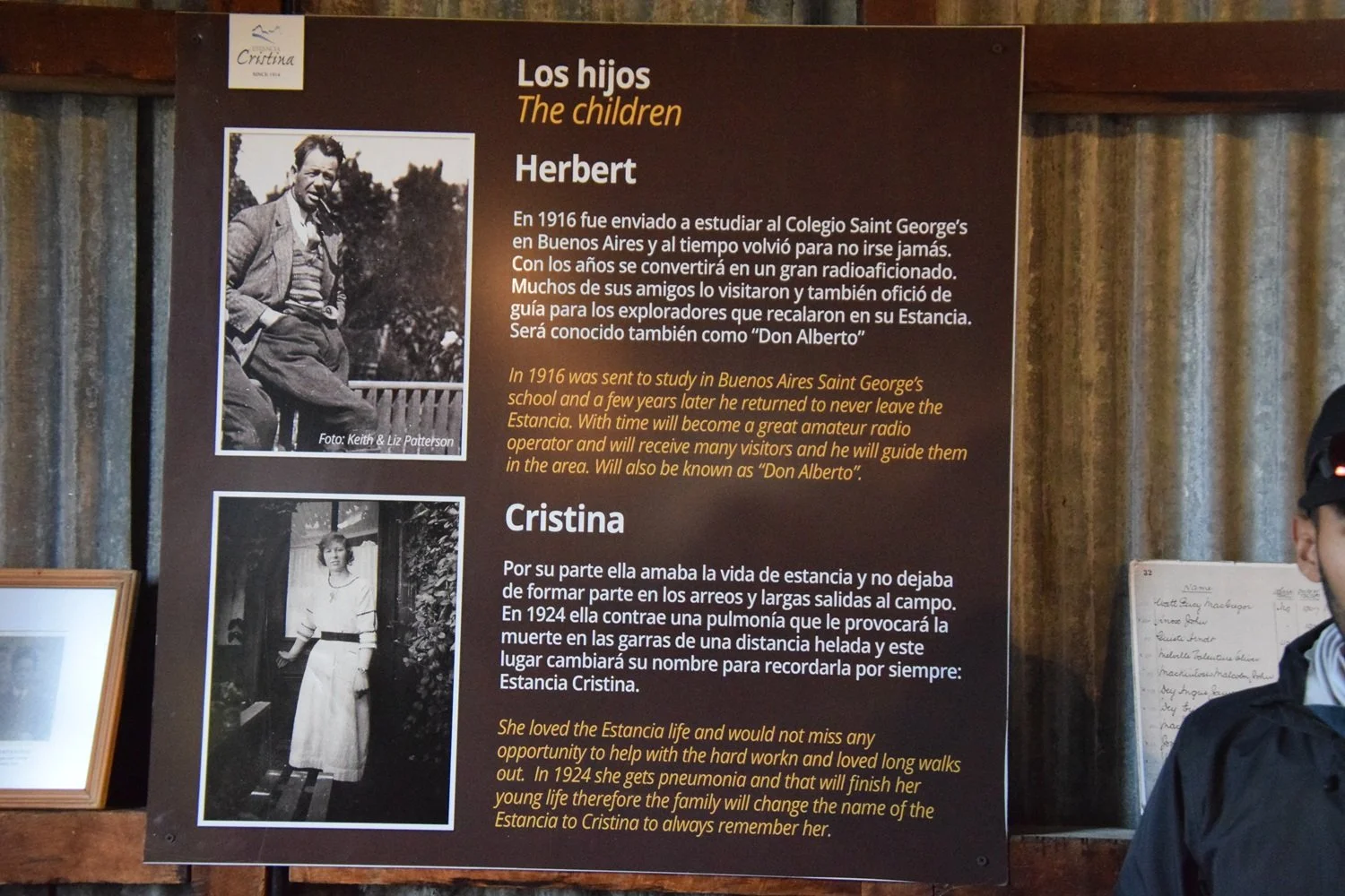
The sheep shearing shed is now a museum with lots of artifacts and pictures of their lives in this remote area. The smell of wool, dust, and leather still stood strong among equipment that has not been used in 50 years. I stayed there a long time, reading each poster that explained their life.
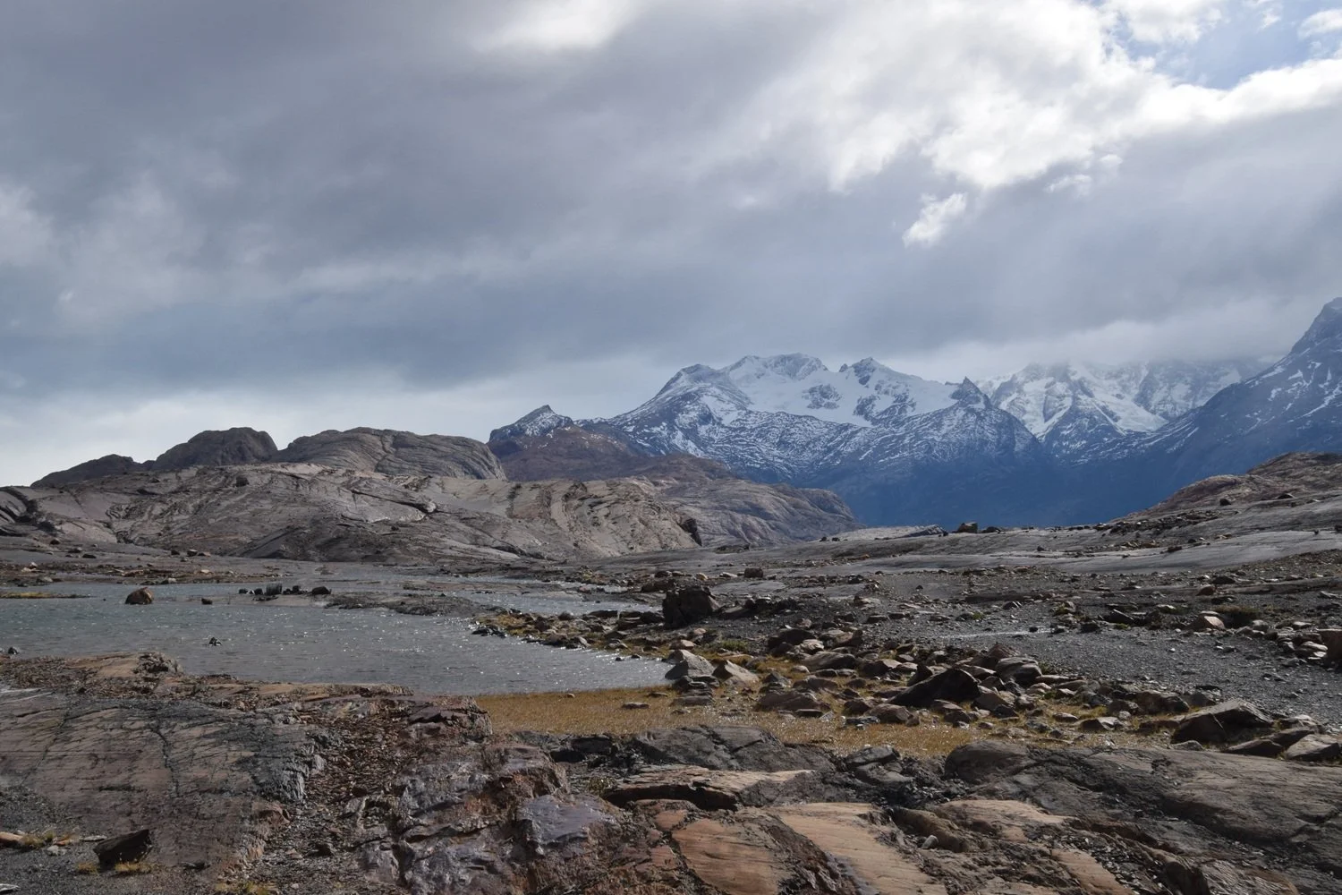
This desolated stretch was still a glacier when Herbert was a young man.
They had two children. Cristina, who died at age 20 from pneumonia. There were no doctors, and probably no medicine to help. Their son Herbert was sent to boarding school near Buenos Aires when he was 14. He returned some years later, never to leave again. The ranch was named after Cristina.
When the Masters took up the land, they would own it in 30 years. 25 years later, the government created a national park around them, and the deal changed. They were given grazing rights and could stay on the land as long as the family stayed there.
I looked through the information carefully, intrigued by Herbert and his boarding school years in Buenos Aires. Did he like it there, going from isolation to city life? Did he want to come home? Maybe he hated it there. All I could find out was he went and came back to stay.
Herbert had no children, so he was the end of the line. A woman, Janet Herminston, came to live with them to take care of the elder couple in their later years. Herbert married her so she could hang on to the land until she passed away.
It was a stark life, but they all lived to an old age. Percival Masters made it to 100.
There were rare visitors, mountain climbers and scientists, but most of their days were spent alone. Herbert became a Ham radio operator and had conversations with people around the world. But most days were spent working with sheep. Winters were particularly harsh, with only a few hours of daylight each day.
The glaciers were much bigger then. There are large areas now that are barren, scraped-off ice where glaciers were when Herbert was there as a young man.
I kept trying to imagine the ice fields as they were 100 years ago. What life would have been like in this remote area. If you needed anything, you had to figure out how to make it yourself or wait until the following summer and hope it would be there when you took your wool to the other end of the lake.
There was a lot of information about the ranch, about sheep raising and history. What was missing was Herbert’s actual story. He lived there for most of his 82 years, but I got back on the boat wondering about him.
What did he think about? What did he feel when he got on his boat for the 14-hour ride to the other side of the lake? Did he think about Buenos Aires?
Did he ever kiss a girl?
I don’t know. That question haunted me most of the ride back across the lake.
Tales of Small Texas Towns
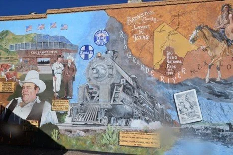
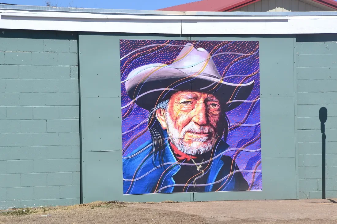
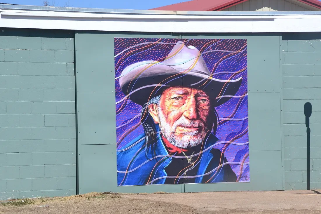
A mural in Alpine, Texas. Many small towns have great murals.
Four stories about towns in West Texas
Alpine Texas is a small desert mountain town that got “small town” right
Alpine, Texas is not in my top 10 favorite places to visit, but this small West Texas town has a lot going for it. It is in a very remote area, but in some ways, it is a cool place.
Alpine was named for its mountainous surroundings, but that seems like a stretch in this barren desert area. It is mountainous for sure, but there are no alpine trees, and probably very little if any, snow. It still beats the original name of Murphyville.
One thing about remote small towns is that you have to create your own entertainment. Often I find them more interesting than larger cities because people had to be creative to make them livable. Some have done better than others, and I think Alpine deserves all the accolades it gets.
It’s about 80 miles north of Big Bend National Park. The town itself is about 5,000 people. It’s very remote. It’s 500 miles to Dallas or Albuquerque, and 400 from Austin.
It has a plethora of murals, which are well done. They are entertaining as well as informative about the history and sociology of the area. A lot of small towns have murals, but Alpine has more than most.
It has an old vinyl record store. There are some very old and valuable albums there, but they know what they have and are not selling them cheaply.
It has some nice restaurants and decent hotels. There is live music and they take their Texas music heritage seriously.
Alpine was a stop along the trail for cattle drives in the 1860s. A little later it was a town for the railroad that was making its way south, which would end the cattle drives as fast as they started.
A description in 1888 said the town had about a dozen houses, three saloons, a hotel and rooming house, a livery stable, a butcher shop, a drugstore, and a post office.
Unlike a lot of small towns, Alpine is not shrinking. In 1920 it had 1,000 people, and that rise to almost 2,000 in 1930. By 1950 it reached 5,200 and is at about 6,000 today.
It still has a lot of old buildings that are more than 100 years old.
There is a walking tour of the downtown, with historic buildings all around. There are a lot of art galleries, bookstores, record stores, and restaurants — all the cool things you want to see in a small town.
You can stay at hotels and eat at restaurants that are 100 years old.
There is a great museum of the area’s history on the Sul Ross University campus.
Kokernot Field is a famous baseball stadium built in 1947 for a semi-pro baseball team that still lives. Sports Illustrated called it the “Best Little Ballpark in Texas.”
There are also a couple of driving tours that will take you through some of the most scenic areas you will find anywhere. One makes a circular trip to Big Bend and does not backtrack. Another goes from Alpine to Marfa, to Fort Davis, and back to Alpine.
Kermit, Texas died and came back to life
The desert of West Texas is bleak. The mountains are to the south, and it's flat as far as the eye can see, and the scenery does not change. It is brown most of the year, and the sky is clear — no clouds and no rain expected.
Settlers made a go of it in the late 1800s, and it was a tough existence. Small towns did spring up as the railroad made its way west, or as the army put up forts and so forth. A year or two of drought could send the settlers flying away in defeat.
Some towns survived, and some did not. There are a few that went to the brink of death but made a comeback. One such town was Kermit, which was all but gone when the oil boom brought it back.
Kermit was the county seat when the county was organized in 1910. Before that, it was a wasteland, but there were a few people around. Kermit was started as a center for area ranches.
It is about 10 miles from the lower edge of New Mexico, and about 100 miles from Big Bend National Park and the Mexican border.
The town was named after one of Teddy Roosevelt’s sons. It was the original county seat. In 1916 a drought chased most people away, and it declined from there. In 1924 there was only one family left, and only one student attending the local school.
Oil was discovered on July 16, 1926, and the town got a new life thanks to the oil boom. By 1927 it had 1,000 people, and by 1929 it was up to 1500. It was incorporated in 1938 and continued to grow. It got its first bank and the first hospital in 1946.
The oil boom lasted through the depression, and the town kept growing. By 1960 it had 11,000 people. It has declined since then as most small rural towns have, but it still has around 6,000 and is a decent enough small town.
The town is not a tourist attraction by any stretch, but it is a nice enough little town. There are hotels and some nice restaurants.
It’s seven miles from Wink, Tx., the birthplace of Roy Orbison. Wink has about 1000 people today, and followed the same pattern as Kermit. No doubt Orbison played music in Kermit at some point.
One small Texas town stayed tame in the Wild West
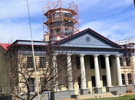
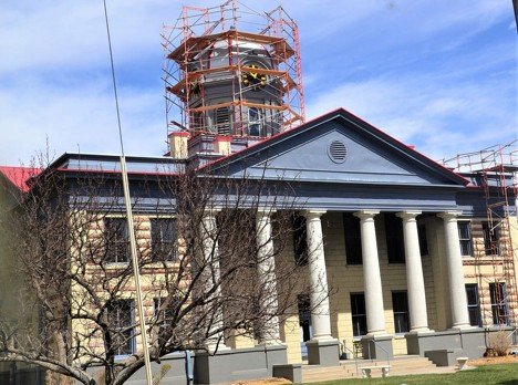
I like to see historic buildings taken care of, but it is still aggravating to come across a small town with a courthouse under repair. I have a lot of pictures of courthouses and quite a few with scaffolding like this.
Fort Davis, Texas, is a very small town in a remote area of west Texas. It has roughly 1,000 people, and it has been at about that size for several decades. It’s not even an incorporated city, which makes a nice courthouse like this somewhat of a surprise.
The town is the highest point in Texas, at nearly 5,000 feet above sea level. It was started because a fort sprang up there during the Indian Wars of the 1850s, called Fort Davis. It was named after Jefferson Davis, who would become the president of the Confederacy.
It was strategically located at the intersection of two major trails settlers were using to go west. Today it is at the intersection of state highways 17 and 118. It’s about 100 miles from the Mexican border, and the closest towns are places like Marfa or Alpine, also small towns in the middle of nowhere.
The nearby Fort Davis is the most well-preserved military installation of the mid-1800s. Forts were set up at strategic locations to defend settlers and mail delivery, against Indians.
With its higher elevation, it is not as hot as some areas of Texas and has been a resort-type place for the wealthy at various times. For whatever reason, the town has never grown into much of a tourist area. It has avoided deteriorating as many small towns have over the years. This very small town was almost pristine in appearance.
Unlike a lot of old west towns, its reputation is fairly pristine as well. Usually, when a town sprang up, it was for mining, the railroads, or for a new fort in the area. Gamblers, bar owners, and prostitutes were usually soon to follow.
There was probably some of that in Fort Davis, but I could not find many tales of wildness. Maybe that is because it did not come into existence because of the fort. There was a small town here already when the fort was created, and it had been there a long time. It was also the site of an old Indian settlement.
The area is a high desert, so there are a lot of rocks and sand and about everything is brown or grey. The scenery is still spectacular with all the rock formations and varied landscapes. There is a 75-mile loop you can drive around the mountains of the area, which is well worth the two or three-hour long trip.
Fort Davis was an interesting stop on the way from Big Bend National Park, back home to Kansas. We still had a long way to go, but there was no rush. It is probably not a place I will go back to, but hiking in this area would be very cool. There are a lot of trails in the area, and you can trace some of the ancient trails Indians, as well as settlers, used.
A note about the history
It is impossible to explore this area without a lot of information about the Indian wars and the Civil War.
It was a different time and a different world than what we live in today. Hopefully, we are more civilized now. That can be debated.
It was the heart of both the Confederacy and where land was stolen from the Indians. I am not sure how much slavery was practised in this area. There were not all that many settlers here, and most were passing through on their way to California. Still, the area supported the Confederacy. The fort, the town, and the county were named after the president of the Confederacy — Jefferson Davis.
I don’t think it is wise to cover up, destroy, or ignore history. It is our history, with both the good and bad parts.
Shafter, Texas went down the Shaft
There’s something mystical and appealing about remote places. They seem remote to us as we speed down a highway at 70 MPH, but just imagine how it felt going not even 5 MPH in a wagon or on horseback 150 years ago. It would take days, if not weeks, to get to civilization that we get to today in an hour.
I wonder what possessed people to want to come to these rugged, remote places. My friend wonders what possesses me to go to those places today. They had to contend with hostile Indians whose land they were trespassing on, as well as snakes, a lack of water, cold, heat, and many other natural dangers.
They were chasing fortunes and some were just chasing a job that would provide food, clothing, and shelter.
The miners who worked in this town were Mexicans, as well as a lot of African Americans. These harsh conditions brought together people of different races and cultures, and they lived together well.
Being very remote is comforting in a strange way. The silence can be suffocating but that too has an appeal. Still, I think I would not find it as interesting if I lived here full-time with no modern conveniences.
Shafter, Texas is one of these places. It was once a silver mining boom town but is a ghost town now. It had 11 people in the 2,000 census, and probably fewer in 2020.
At one time it had 4,000 people and several businesses. Like a lot of boom towns, when the silver dried up the town did too.
Shafter is a ghost town about 25 miles from the Mexican border on Highway 67. It’s about 40 miles south of Marfa.
Shafter was started in the late 1800s when some people discovered silver. They got the commander of Fort Davis, about 25 miles away, involved and a town was slowly built. The town took the name of the Fort Davis commander. They didn’t know how to mine silver and didn’t have the equipment, so it took a few years for the mine and the town to get rolling.
The town was started in 1880. It was not until 1882 that a mining operation was established. It was a typical company town, with the company providing housing for the workers, as well as pay. There are lots of horror stories about company towns, but there are some positive ones as well.
It was quite a task getting mining equipment to this area in the late 1800s. It was probably at least 100 miles from the nearest railroad. There were no roads, so they had to make roads to transport the equipment.
The town grew steadily and by 1940 had 4.000 people. Silver prices crashed and the silver itself ran out. By 1943 the population was down to 1500, and by 1949 it had 20 people.
There have been a few attempts to reopen the mine, but none have succeeded. The town has grown to 100 people a time or two since 1949 but is back to that level now.
The only building still standing is the church. There were some small houses in the area, but none at the original townsite.
Everything is Bigger in Texas
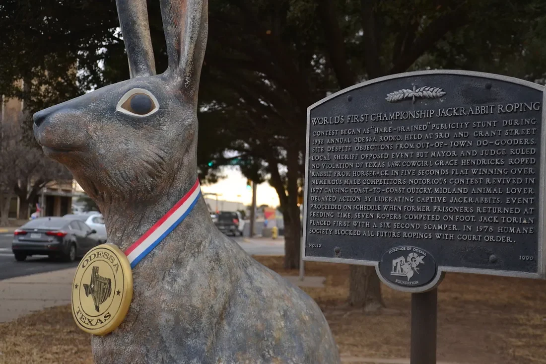
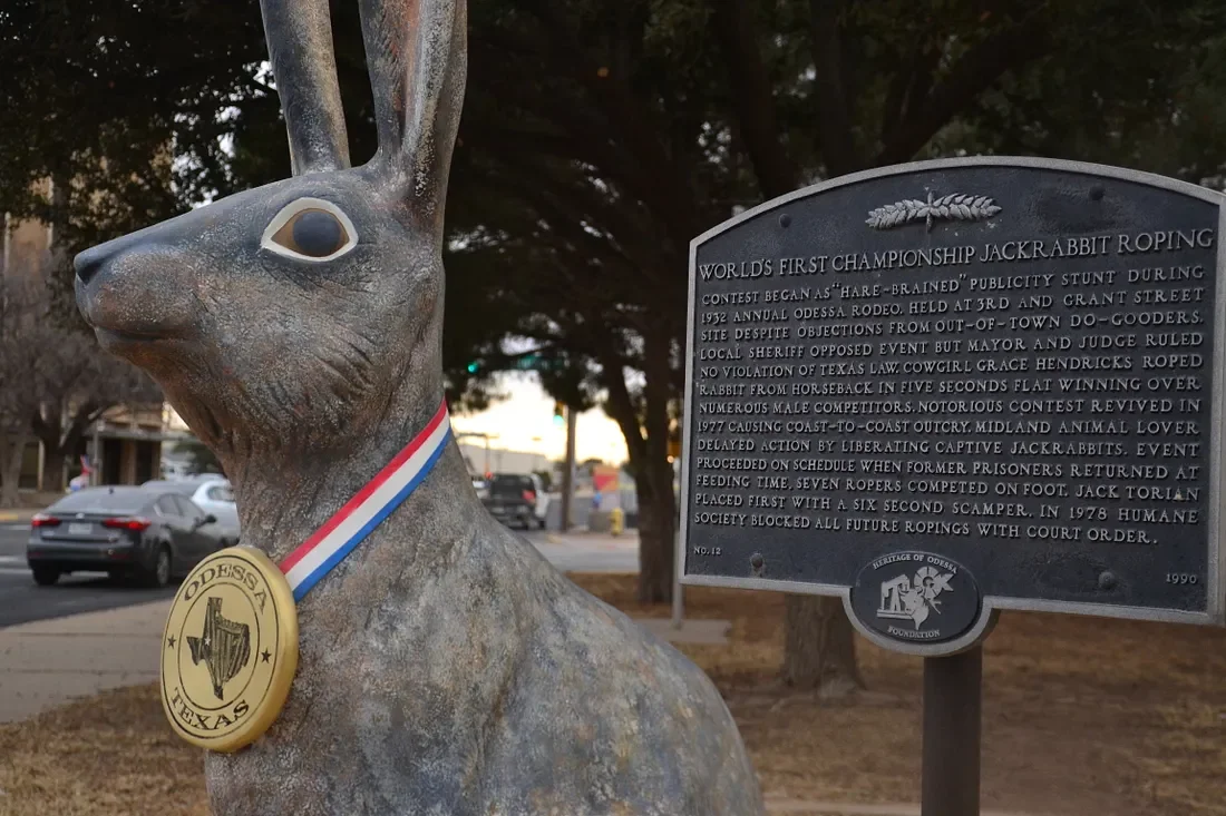
Everything is bigger in Texas, they say. It might be true. Odessa has a bunch of jackrabbit statues that are about four feet tall, spread around town. In the West Texas desert, there is not a lot of scenery, so folks create their own entertainment.
A lot of towns have things like the jackrabbits. In Amarillo, they have the Jackalope, which is said to be a mythical being. But in Odessa, it was bigger-than-life jackrabbits.
A real jackrabbit is about two feet tall. These statues are around four feet, and all are painted.
They tried to have jackrabbit roping, just like they do competitive cattle roping at a Rodeo. This was in 1932, and even then animal rights activists were opposing the event, “out of town do-gooders,” they were called.
Anyway, Grace Hendricks, a young cowgirl, won the event by roping a jackrabbit in five seconds on horseback, beating all the men and boys who competed.
The event was revived in 1977, and it gained national attention — or should we say national opposition from animal rights groups. Local legend has it that someone kidnapped the jackrabbits to try to stop the event. The jackrabbits escaped and came home at feeding time.
The event was held with competitors roping jackrabbits on foot. In 1978, the Humane Society managed to get a court order banning the event from happening again.
Maybe it was revenge, or maybe it's because there are a lot of them around here; someone came up with the idea of statues. There are about 40 of them, and you can get a list from the chamber of commerce. We found most of them.
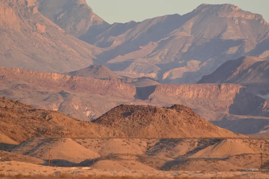
At Big Bend
We made it to Big Bend National Park a little before dark. Planning some hiking and roads to drive through the park.
We drove through a lot of deserts today. The weather was nice, around 70, but I could imagine how hot it gets in July or August.
I am still pretty amazed that people were able to live here before modern conveniences came along.
Small Texas Towns on the Way to Big Bend
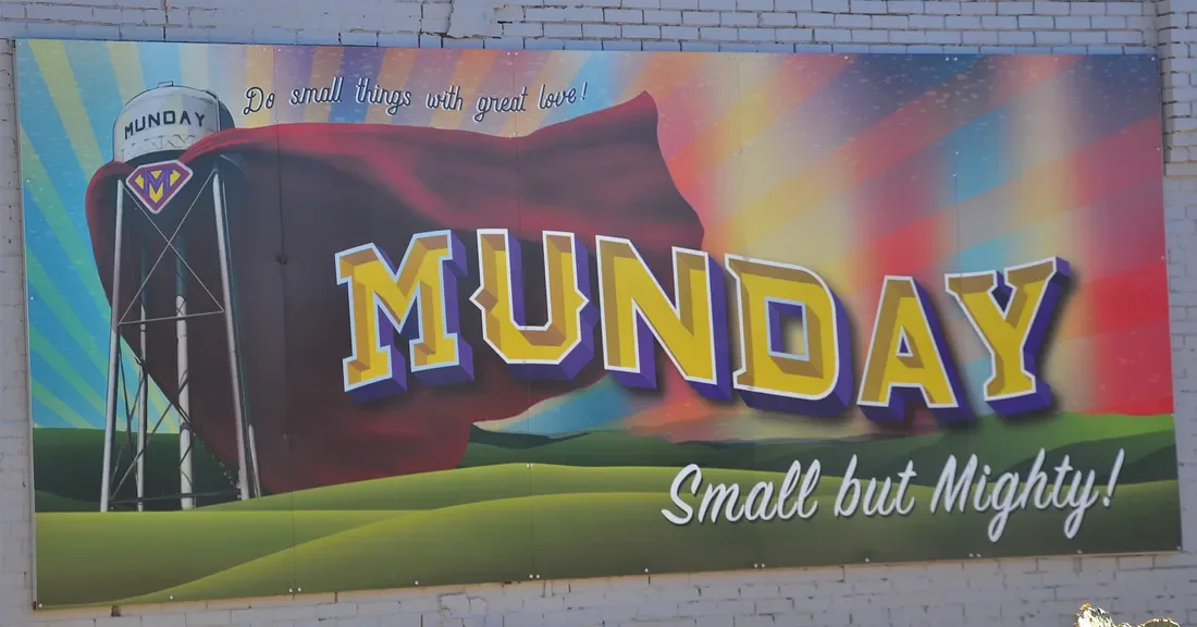
A mural welcomes us to Munday, Texas.
We got off to a slow start Saturday and only made it as far as Wichita Falls, Texas, on our way to Big Bend National Park. Sunday we managed 155 miles from Wichita Falls to Abilene.
Part of the adventure is discovering small towns, and part is finding a place to sleep on the way. That is the biggest reason it has taken us a day and a half to go 155 miles.
We spent nights in Wichita Falls and Abilene. Those are big towns by our standards, and oddly perhaps, it can be harder to find quality cheap accommodations in bigger towns. Often those places are not in the best parts of town, and sometimes the motels are used for … things other than sleeping.
A new trend we found was charging a deposit when you rent the room. One place wanted $100 and another wanted $50, along with the price of the room. They said if I paid cash, I could get the deposit back in the morning if nothing was damaged.
I declined both offers. I was born at night, but it wasn’t last night.
We found a cheap place in Wichita Falls that didn't have a refrigerator. It was cold outside, so we left our cooler outside our door. It was fine in the morning. The room was not really warm, but otherwise fine.
Abilene has a plethora of murals and a lot of statues. One place had statues that were scenes from children’s books — like the Three Little Pigs, the Three Bears, and the Three Kittens — and some I had not heard of.
There was a lot to see and we kept exploring until it was too dark to take any more pictures. We started looking for a place to stay then. We were tired and that isn’t the best way to go about finding a motel for the night.
In Abilene we went for a budget chain motel on the Interstate. That was the first time we had been on an Interstate highway this trip. This one is a bit isolated with no restaurants around. Nice room though.
The best cheap hotels are in the small towns. They are usually owned by local people and the quality is just better. Some businesses take more pride in their product than others. Chains are cookie-cutter operations that often have the bare minimum of standards.
We will likely end up at a smaller town tonight. We have reservations at Big Bend, but since we don’t know where we will be when night falls, we have to find rooms as we go along.
Small towns
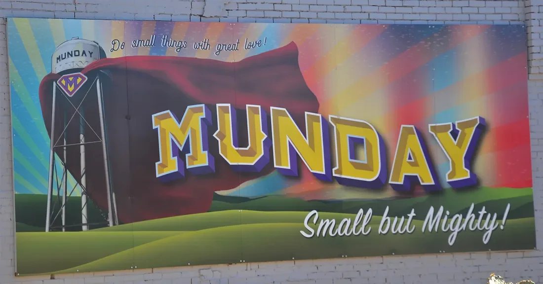
We came across the little town of Munday, Texas, named after a postmaster. We were going to pass it by, but we happened to see a mural from the highway and stopped to take a look. It has three or four blocks of downtown.
We were surprised to find a lot of murals and outdoor art in this town. For a town of 1100 people, it seemed to have a lot going on. We stopped at another small town, Haskins, that had murals and a cool-looking courthouse.
A lot of these towns sprang up with whatever was going on at the time. The arrival of the railroad, an outpost for the army, the oil boom. Some of them sprung up overnight and disappeared almost as quickly when their reason for existence faded away.
Some towns survived, and some are hanging on by a thread today. Some of those towns have murals and other interesting things to see. Some do not.
The Frontier Museum
The Frontier Museum in Abilene gives a great look into the history of the area. It has been a hostile land for many years from an environmental standpoint — hot dry summers, storms, snakes, make it dangerous even today. When the white settlers were arriving there was no medicine and no law. You were literally on your own and only the fittest survived.
The Mythical American Cowboy
The Museum of the Frontier in Abilene was a great place to get a glimpse of the history of this part of Texas. It was a hostile land for many reasons when the first white settlers arrived. There was a harsh environment with very little water, heat, snakes, and other natural dangers. There were Indians who would attack, and there were bandits.
The legend of the cowboy is pretty much just a legend. As many as half of the real cowboys were black or Hispanics, and even a few Indians. The first cowboys were anything but glamorous. It was a hard dangerous job, driving cattle hundreds of miles from south Texas to the railroads in Kansas.
The cattle drives started in 1866 and by 1880 the railroad reached Texas, barbed wire was going up on ranches, and the cowboy era ended as fast as it started.
There were also some former slaves who went west, and their stories have not been told as much. When they were freed they took advantage of the opportunity to head west and try to settle the harsh land. Many became what we now call cowboys. Some got involved in rodeo, and the sport of steer wrestling was invented by William Pickett.
Even at the end of trail you were not safe. There were lots of swindlers, gamblers, prostitutes, and others more than eager to take your hard-earned money. Probably a lot of cowboys lost their money at the end of the trail.
This was a wild area. It was noted that one person might be an outlaw in one town and a sheriff in another town. I also got the idea that race was not all that important unless you were an Indian. Some who had been slaves became business owners and ranchers.
If you had some money you could become a landowner regardless of race. If you did not have money were a common laborer, you could be a cowboy.
The Comanche and African Americans
There were also Indians who were not pleased with all these settlers arriving. They attacked and killed a lot of settlers, and of course, a lot of them were killed. The Comanche was one of the last tribes to be conquered. They were great horsemen and were fierce warriors with bows and arrows.
The Comanche warriors also had a nasty side. When they attacked a group of settlers they would kill the old and very young, and take the rest captive. They used cruel means of torture at times as well.
Those that were not too old or too young were not killed. They were kept, or sold, as slaves. Indians also had some slavery going on. Especially early in the settlement period attacks by Indians were common. There are a lot of stories of people who were captured and held as slaves by the Comanche or other tribes.
There was a story of a black man — Britt Johnson — who had his family kidnapped by Comanches. He was legally a slave but was treated more like an employee by Moses Johnson, the white man who technically owned him. Lines were blurred on just about everything in West Texas in those days.
During a Comanche raid, some of Moses Johnson’s family were killed, and Britt Johnson’s wife and two children were kidnapped.
Britt Johnson was given his freedom, and some money, so he could go find his family. He found them and somehow got them back from the Comanche.
He was a cowboy for a time, and then drove freight. On one of his trips, the wagon train was attacked by Comanches, and Johnson was killed in the fight.
There was another story Cynthia Ann Parker whose story has been told many times. She was a white woman who had been taken prisoner by the Comanche as a young girl. She was returned to her original family against her will because she had become a Comanche herself. Her son Quanah Parker became the last great Comanche chief.
There were lots of stories of people who were kidnapped and later were released by the Comanche.
The era of the cowboy, and the era of battles with the Comanche, ended about the same time in West Texas.
Then came the oil discoveries and life changed drastically for many.
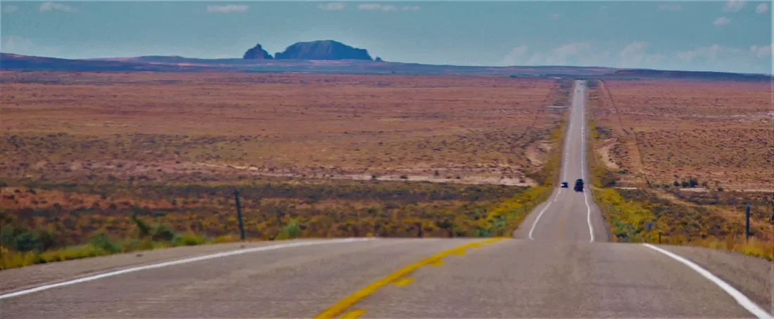
Headed to Texas, Cheap Travels
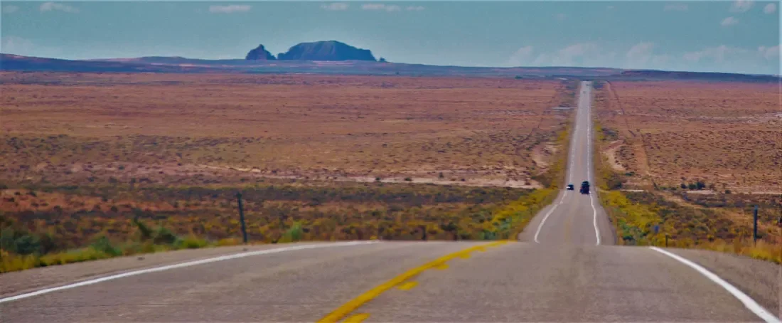
Getting ready to hit the road again. This time we are headed south to Big Bend National Park in southwest Texas. Where we are now is cold. We got to 30 today and that was as warm as it’s been all week. Should be warm, if not hot, in southwest Texas.
One of my dreams once I retired was to travel a lot. We like to travel in a car on the back roads and see interesting things along the way. This will be our third trip since I retired last September, so the dream is going pretty well.
My goal is to not have a firm return date, just a vague idea of when it will be. I suppose this trip will be 10–14 days. So if we say 10 it will be 14 because that is how we roll.
I did a travelogue when we went to Utah last October. I may do one again for this trip. Maybe not every day, but often.
There will be no albatross of a camper behind us this time. I much prefer going by car and finding places to stay along the way. We have found some places that were interesting, and we always look for the cheapest thing we can find for lodging. The roaches are clean. What more do you want?
The roaches are clean.
What more do you want from a cheap hotel?
We both like to travel cheap, which is a good thing. We take some food with us, and often it’s just a sandwich and some fruit as we drive down the highway. We stay away from typical tourist traps and try to spend money on things we really want to see, instead of popular attractions.
We have several money-saving tricks, like filling up your water bottles in the hotel room in the morning. We make our own coffee with our own coffee pot that goes with us. Some little things like that save you a few bucks and it adds up, and you can afford to stay longer.
I am not as into the trip this time for some reason. My depression has been acting up even though I am remembering to take my pills most of the time. I think it's just the wintertime blues. Once we get on the road I will be fine.A
First Day at Big Bend National Park
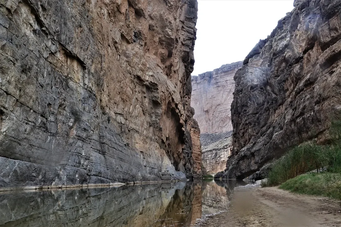
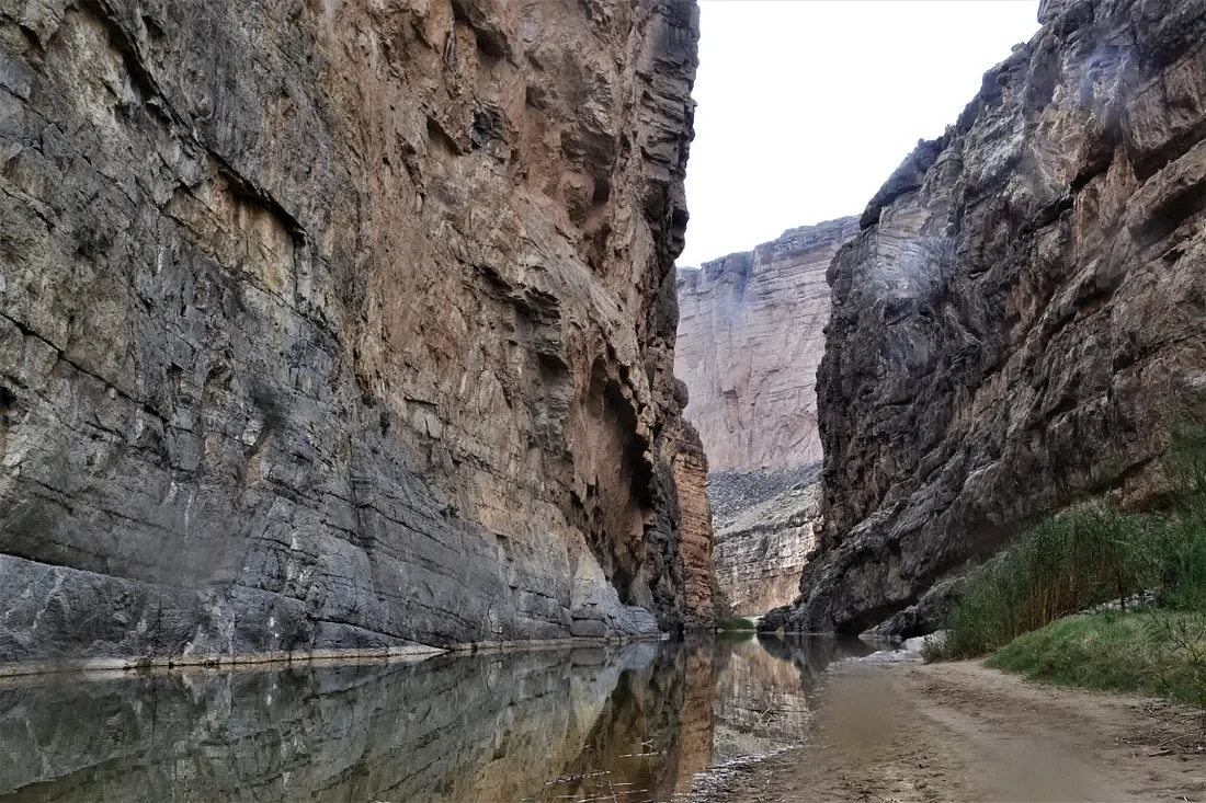
Our first day in Big Bend was mostly driving around, but I managed to get some hiking in. We are staying in Terlingua, which is on the west side. To get anywhere inside the park will be a little drive.
The weather is great for hiking, low 70s, and a slight breeze now and then. This is desert, so there isn’t much chance of rain. They get about 10 inches a year here, which is not much at all.
I made the climb to this canyon. I hiked down to the Terlingua Creek, which the tour paper assured was most likely dry. It was not today and had a pretty good stream running through.
I waded across in water that was up to my knees, so I was fairly wet. There were quite a few people around, and most were taking their shoes off. I thought about turning back, but I was already wet and saw no real reason to stop.
There was a fairly steep climb up one side of a hill, and then a climb down the other side that was not as steep. At the bottom was the canyon in the picture above.
From the creek, over the hill, and down to the canyon was a little more than four miles round trip. It went pretty well, and having wet feet was not a problem. I thought it was well worth the effort. I was a little surprised at how easy the hike was. Maybe it was the dry air or stopping to drink some water every 10 minutes or so, but I was not tired at all.
I was surprised at the level of vegetation in the desert. We are a little early to see cactus blooming, and before most plants get into summer mode. Cactus, yucca, and many other plants were still growing all around.
There is a central basin at Big Bend. The road snakes its way through the desert floor in the picture above. Mountains on each side. We had to drive up and down the mountain at each end, which was an adventure but nothing too scary.
Winked out by Roy Orbison
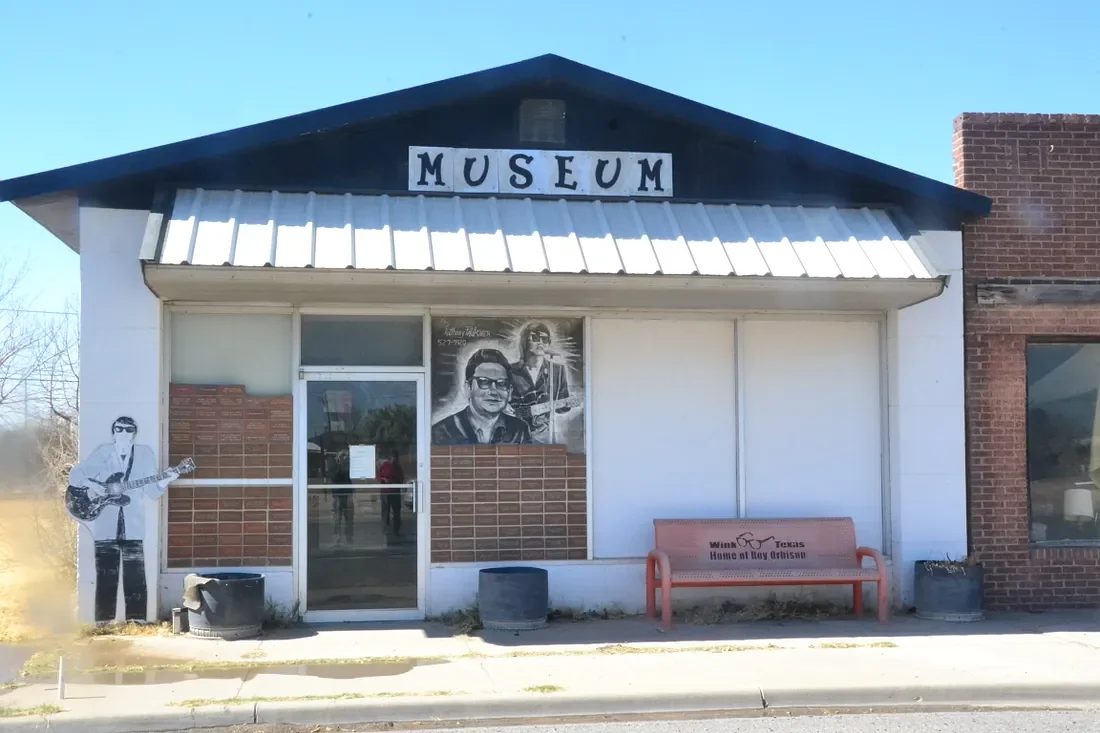
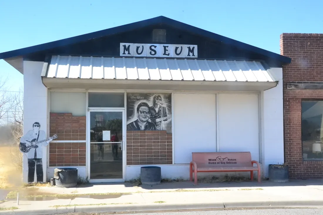
They say the town was so small if you wink you will miss it. That’s pretty much what happened when we made a detour to Wink, Texas, to see the town where Roy Orbison grew up.
I was aghast at a young man who did not know who I was talking about when we were about to leave Big Bend National Park. He didn’t know the Traveling Wilburys either. Oh my.
We were 150 miles south at Big Bend National Park, where there are no phone signals and no Internet. Wink is a town of fewer than 1,000 people, and it is an old oil town that has about dried up. The museum that bears his name is a one-room building and is by appointment only.
I tried calling on the way, and once we got there. There were more phone numbers on the door at the museum, and I tried them all.
No one was available to give us a tour. I looked through the door and saw a few things. I listened to some Roy Orbison as we drove down the highway. That will have to do I guess.
Lost on the Chisos Trail
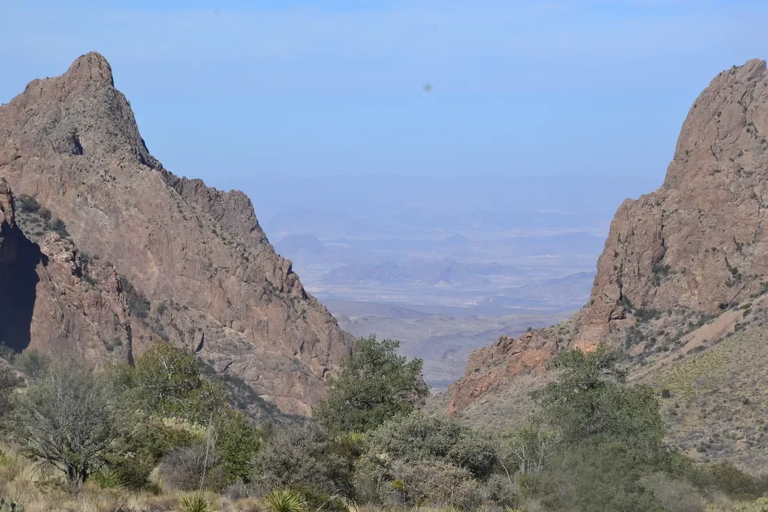
Chisos Basin area of Big Bend National Park. I wanted to do some hiking and got a bit more than I had bargained for.
I got lost.
The hike was the Chisos Basin Loop Trail, which was a 2-mile trail that was not supposed to be very hard. I took a wrong turn, and then took some bad advice, and found myself way off course on a trail I did not mean to be on.
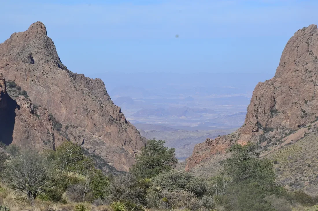
I was at the Chisos Basin area of Big Bend National Park. I wanted to do some hiking and got a bit more than I had bargained for.
I got lost.
The hike was the Chisos Basin Loop Trail, which was a 2-mile trail that was not supposed to be very hard. I took a wrong turn, and then took some bad advice, and found myself way off course on a trail I did not mean to be on.
There is a place called the Window, where two mountain ranges form a frame that looks like a window. I could see it from the trailhead, and continued to see it as I hiked the trail.
I got to an intersection and the signage was not exactly clear, but I thought it was clear enough so I pushed onward. I started to think something was not right when I could no longer see the window. I had also been going downhill for a long time.
I passed by someone and asked them if this was the right trail. I did not say the name correctly, and they told me it was the right one, so I kept going. By then it was getting to be around noon and getting hotter by the minute. I looked at my step counter and I was at 3.3 miles and did not seem to be close to the end of the trail at all.
I was going back uphill though, and I took that as a positive sign.
I was running low on water and dreading the thought of having to backtrack. I thought I would feel bad if I was almost there and went all the way back. I ran into a man and a woman who were checking their map.
After talking with them and looking at their map, I saw that I was very far off track. I would indeed have to backtrack. By this time, it was 1 p.m., very hot, and I was out of water. They gave me some water. By the time I got back to the trailhead, I had been gone for almost five hours and hiked eight miles. My wife had gotten tired of waiting and went off exploring. She was upset, thinking I had changed my hiking plans without telling her. At least she felt some sympathy after realizing I had been through a pretty tough day.
There was no phone service available, so there was no way to contact each other.
I was worn out after that long hike. We drove around some more and got back to our room a little after dark.
The allergies are still hitting me hard, but I am recovered from the long hike as far as I can tell. They helped me recover to some degree.
They were headed back down the trail towards where I had started so we hiked together.
I was also having some heavy-duty allergies, which is ironic in the desert, but things are blooming everywhere. There must be some pollen I am not used to because I have not had an allergy attack like this in many years.
So I was hiking along, very hot and tired and having some bad allergies — sneezing, eyes burning and itching, and general misery.
Ghosts, and Ghost Towns Along the Border
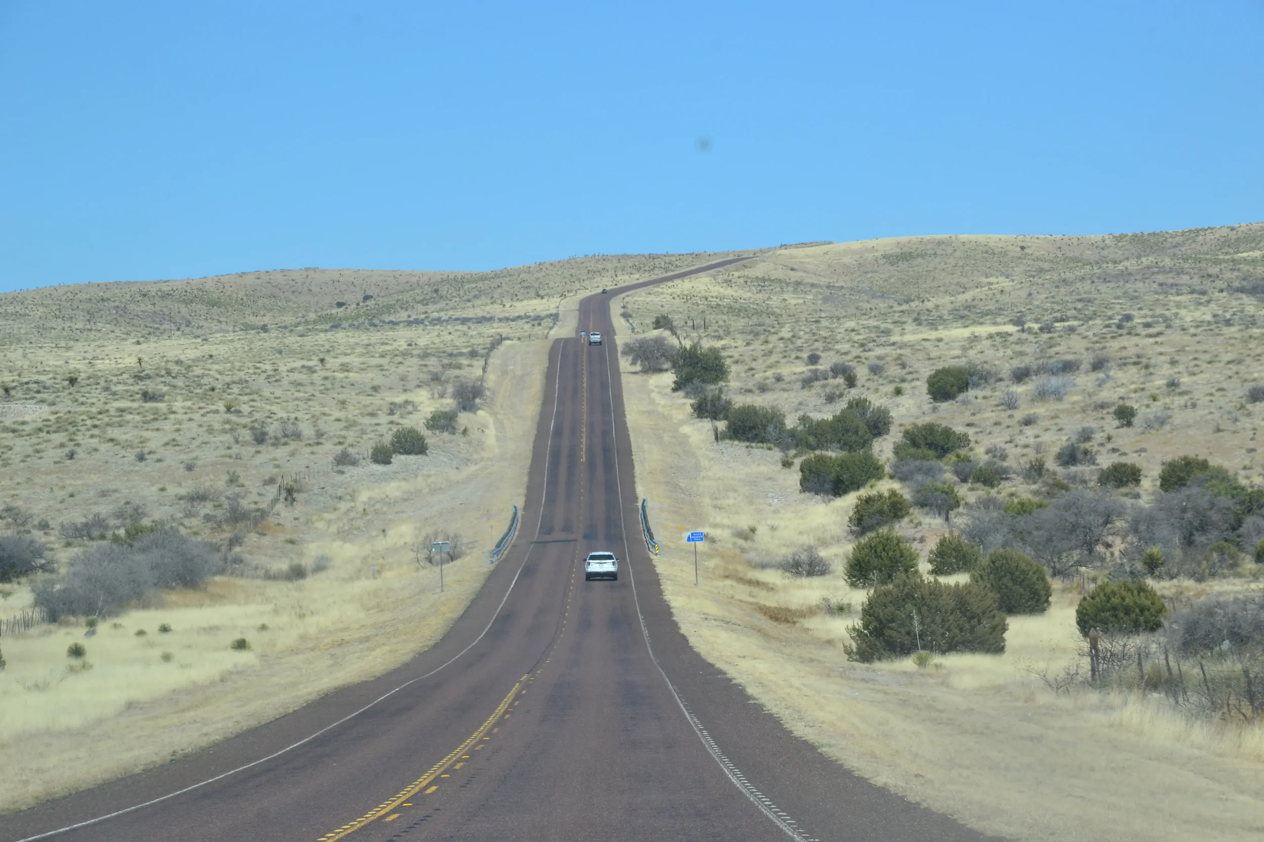
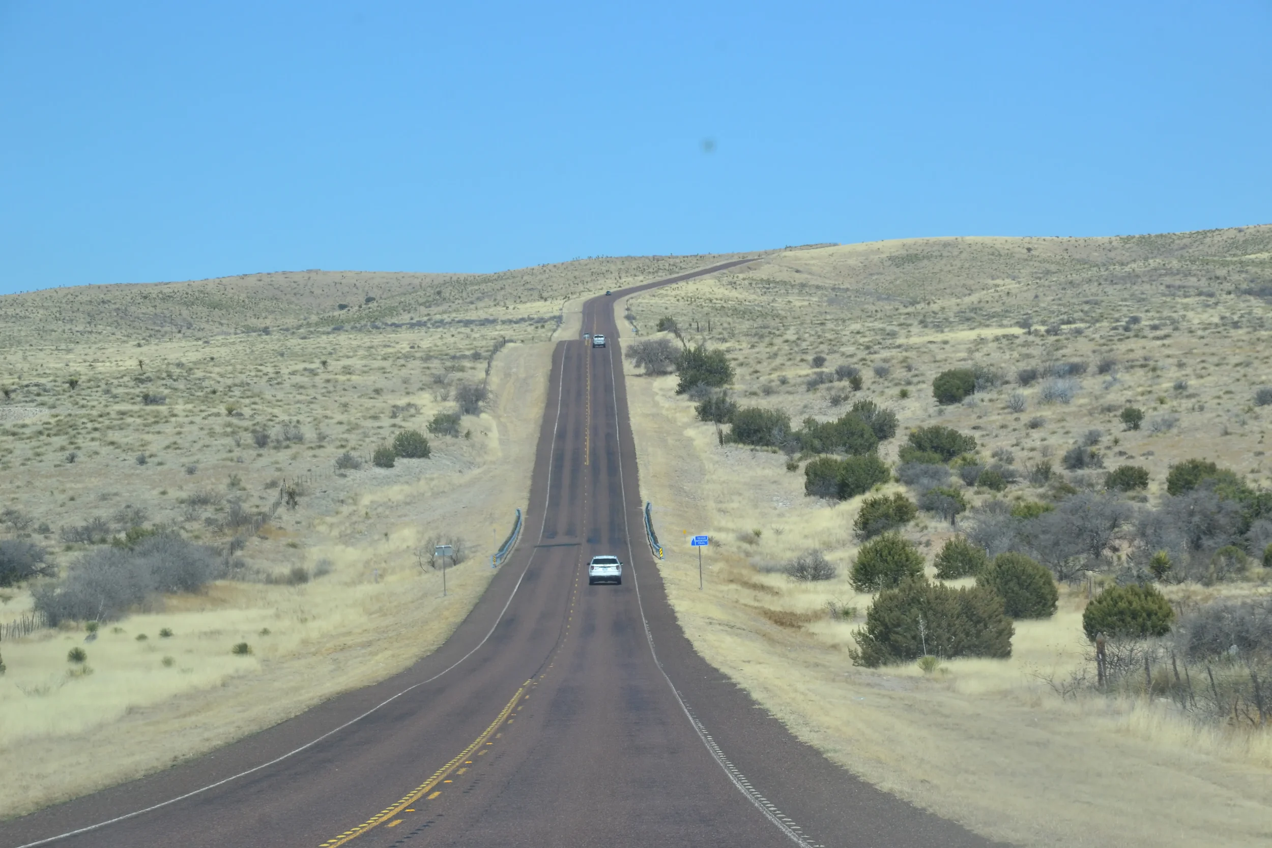
Small ghost towns and other remnants of attempts to tame the west dot Texas State Highway 170 along the Rio Grande and the border with Mexico.
It is a harsh but beautiful drive through the mountains, roughly 60 miles from Terlingua to Presidio. You can see the Rio Grande often during the drive, and there are lots of places to pull over and go down to the river. It was an amazing drive, but what struck me most were the ghost towns along the way.
The drive through Big Bend National Park was inspiring. I was skeptical when they told me the drive onward to Presidio was even more impressive, but “they” were right for once. From Presidio northward to another ghost town — Shafter — is only 20 miles or so, but is almost as impressive as the drive along the Rio Grande.
There were Native Americans here for thousands of years, and there were Spanish explorers in the area from the 1500s onward. It was a harsh environment no doubt. Then white settlers came in the early 1800s, and even more in the late 1800s with silver mining.
Several towns sprang up overnight for silver mines, or later for oil, and most of them disappeared just as fast.
The environment was hot and dry, there were snakes and other wild animals, as well as Indians on the warpath now and then. It was a rough life, and people still struggled to survive. There was also a lot of appeal to the area, to the rough environment. I heard more than one person say they didn’t intend to stay there, but they did.
While at Big Bend we stayed in Terlingua, which is between the national and state parks by the same name. Just a mile or so away is another settlement called Study Butte (pronounced stoody boot). Both were the sites of big silver mines in the early 1900s, and both also made Mercury through the 1940s.
Once the silver mines were no longer profitable, the mining companies withdrew and they both became ghost towns. The towns are getting a resurgence now with tourism, as launching points for Big Bend and the river.
The silver miners also changed the environment significantly. Before the 1900s the area had tall grass which was great for grazing cattle, and there were a lot of trees. Virtually all the trees were cut down for the Mercury-making process. That left nothing holding the soil down and it all blew away, and there was no place for the grass to grow anymore. The desert quickly overtook the area and it remains desert today.
The two-lane blacktop winds through the mountains out of Terlingua, and around each curve is another gorgeous scene that would make a great photo. We pass up most of them.
There are other sights as well.
The home of Pablo Acosta is one that comes fast. It is a very nice house, almost a mansion, beside the road after leaving Terlingua. Acosta was a major drug dealer and controlled most of the drug traffic across the Rio Grande in the 1980s. He was finally killed after an ambush in a nearby canyon in 1987.
There is also Contraband Pass, which some locals told us about. There is a relatively easy pass through the mountains that has been used for centuries for trade. A hundred years ago a plant that was used to make candles was smuggled through that route and traded to businesses on the American side of the border.
We didn’t see any signs of that sort of smuggling, but there were places where people left trinkets, walking sticks, and so forth to be purchased. There was a can set up to hold the money and it was on the honor system. It’s illegal for them, and it's illegal to buy the trinkets.
As we went on down the road we came to Lajitas, another town that has not quite made it to ghost town status. It is having more of a resurgence as there is a fancy resort and golf course there now.
There were more ruins here and there as we wound through the mountains, just small piles of rocks that were a building of some kind.
It is ironic perhaps, but Presidio is the only town that is still functioning as an actual town. It is the only one that did not come into being because of mining. It was established by the Spanish, and there is the Mexican town of Ojinaga just across the river.
From there we went north on Highway 67 to another ghost town. This drive was gorgeous as well, but it was a different kind of mountain, with much different rock formations.
About 25 miles north of Presidio is Shafter. This once prosperous mining town now has five or six families, a church, and that is about all.
About 40 miles north of Shafter is the town of Marfa, which was a nice little town that seems to have a lot going on. The town of Alpine is just 10 miles to the east, and it is similar. Both appeared to be bustling small towns with a creative arts scene.
Riding the Rio Grande - Life on the Border
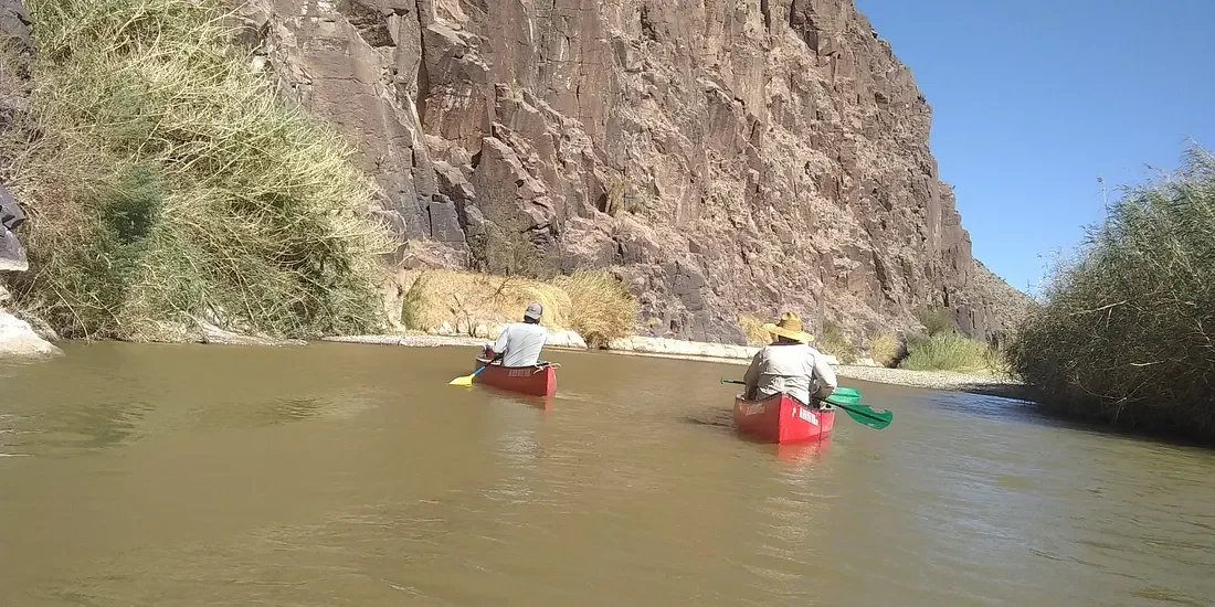
A canoe ride down the Rio Grande is about as peaceful as you can get. The flow is slow and the water is not deep. We went on a guided tour before we left Big Bend, National Park. The tour was in a state park by the same name, which is just an extension of the park itself.
Tall brown grass on both sides of the river creates a different world. A person could forget they are in a desert for at least a little while.
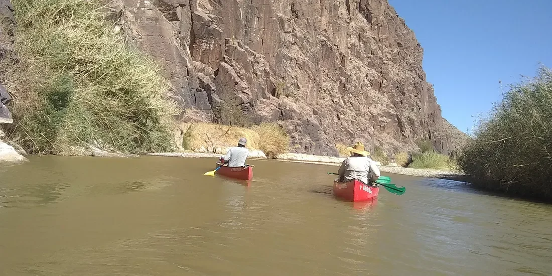
A canoe ride down the Rio Grande is about as peaceful as you can get. The flow is slow and the water is not deep. We went on a guided tour before we left Big Bend, National Park. The tour was in a state park by the same name, which is just an extension of the park itself.
We were not very familiar with canoeing and we were given some basic instructions, which were good enough.
You would have to really mess up to turn over, but it could happen. There were some “rapids” that were a little tricky, but our guides helped us through.
Steering a canoe is not as easy as you would think, and we went down one rapid backward. We got to a point where it was going to be too hard to turn around, so we just went back and it worked out fine.
Tall brown grass on both sides of the river creates a different world. A person could forget they are in a desert for at least a little while.
150 years ago when the west was being settled, and this area was still in contention with settlers, Mexicans, and Indians, the area was more green and the river had more flow.
Dams have been built and that has caused a smaller water flow, and the environment has changed. There was a lot of silver mining in this area 100 years ago, and all the trees were cut down to have fires that were needed to work with the silver.
Once the trees were gone, there was nothing left to hold the soil in place. Once a drought came along the topsoil was blown away, leaving nothing but sand. That made the area turn into a desert fast and the grass never came back.
March is the dry season so the water level is low. In the fall the level is high enough for rafts.
We ran aground a few times in the canoe, but it was easy to push off with the oars we had.
It is still a very remote area. Our guides told us there are very few people living on either side, and it is a long way to civilization from here.
Before 9–11, no one here paid much attention to the border. Folks on the Mexico side sent their kids across the river to go to school. After the 911 attacks the U.S. got more strict with the border.
In one case a Mexican town depended on infrastructure and supplies from the American town. Once we got stricter with the border, folks in that town had nowhere to go to get anything they needed. That area is a ghost town now.
There is a Mexican National Park on the other side of the river, so there is a national park for hundreds of miles on both sides of the border. There are still border patrol people around. You can go across the river easily enough, and our guide told us you can get cited with a misdemeanor if you cross the river.
There are virtually no “illegals” entering the U.S. from this area. The river is easy to cross, but hundreds of miles of desert with no water or anything else is not easy.
The Reality of the Mexican Border
If someone did walk from a remote Mexican town, cross the Rio Grande, and make his or her way into Big Bend National Park and onward, that would be a super-human feat. That person would have to have someone pick them up, or they would have to walk as many as 100 more miles to a town of any size in the U.S.
If a person did that they should be given citizenship and a medal of some kind — not deported.
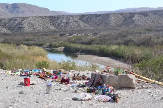
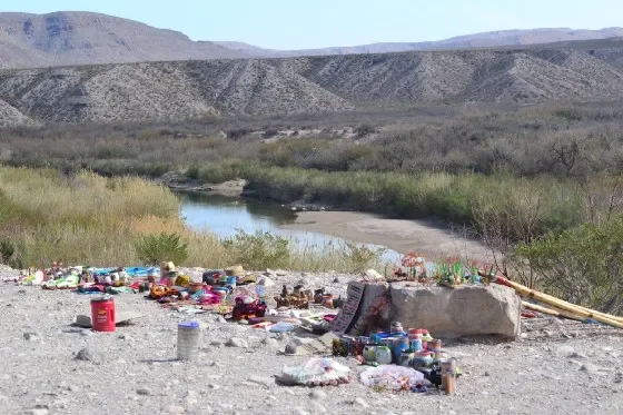
Trinkets and crafts left for sale on the U.S. side of the Rio Grande. Photo by James Jordan
The desert at Big Bend is a bigger obstacle than a wall would have been
It would be easy to wade across the Rio Grande, from Mexico into Texas, without any problem in the remote desert of Big Bend National Park.
There is a lot of border between the U.S. and Mexico, and there is a lot of remote wilderness that is largely desert and untamed. I never knew for sure just what the border was like until we visited it at Big Bend National Park. It’s even wilder and more remote than I had imagined. The other side of the border is also a national park and just as much desert.
I hiked a few trails that went down to the river, and could easily see across to the Mexican side of the river. It is the dry season and water levels are very low.
For centuries people that lived in these parts didn’t worry too much about borders. They did business together and helped each other at times. It’s only become more of an issue in recent years. But even at Big Bend National Park, there are border patrol agents around.
There are no towns of any size to speak of on either side of the border. This is a remote desert on both sides for many miles. Most of the border areas I saw were desert, but there were some ranches and some signs of life.
If someone did walk from a remote Mexican town, cross the Rio Grande, and make his or her way into the park and onward, that would be a super-human feat. That person would have to have someone pick them up, or they would have to walk as many as 100 more miles to a town of any size in the U.S.
If a person did that they should be given citizenship and a medal of some kind — not deported.
Once you crossed the river in either direction you would have at least 30 miles to go before you got to even a convenience store and 100 miles to a town that probably does not have 1000 people. Imagine doing that on foot in intense heat with no water available. It would probably be 300 miles in either direction to get to public transportation.
Trump talked about building a wall. I can’t think of anything that would be uglier than that in this wild area. A few hundred miles or more of dry desert is more of an obstacle than any wall could be.
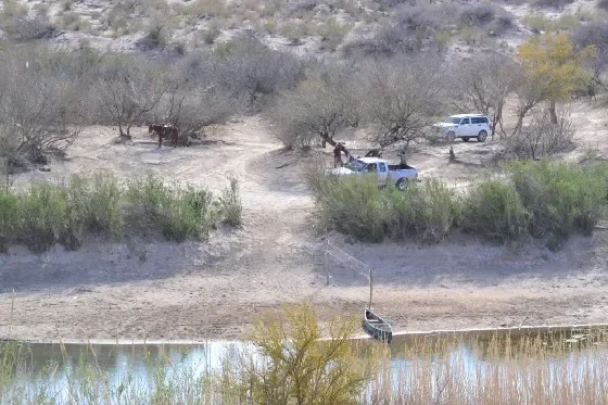
Just across the border, there were people with trucks and horses — and canoes. There are still operating ranches on both sides of the border.
But there is one thing that does happen.
At various spots, there are trinkets, walking sticks, and such, set up for sale. There is a can with a note saying to put your money into the can to support families on the other side of the border.
It is on the honor system, and some of them had what looked like a decent amount of cash in them. I saw several of these setups, and at times they were in very remote areas along a trail near the border. I half expected someone to jump out of the bushes and give me a sales pitch.
No one ever did.
There are warnings posted not to do business with these people. Our government says it encourages illegal entry, and that we should not do so.
The trinkets looked like handmade crafts. I could not tell if they were real handmade art or if they were cheap Chinese knockoffs. I didn’t care really. I stuffed a few dollars into one of the cans and maybe that helped someone a little bit. I didn’t take any of the trinkets.
These people do sneak across the border and put up these things before daylight, and come back in the evening to collect whatever money was made and the stuff that did not sell.
If you are already there, crossing the border is not a big deal. Getting anywhere once you cross the border — in either direction — would be quite a feat.
The Spirit of Place: Peru and Argentina
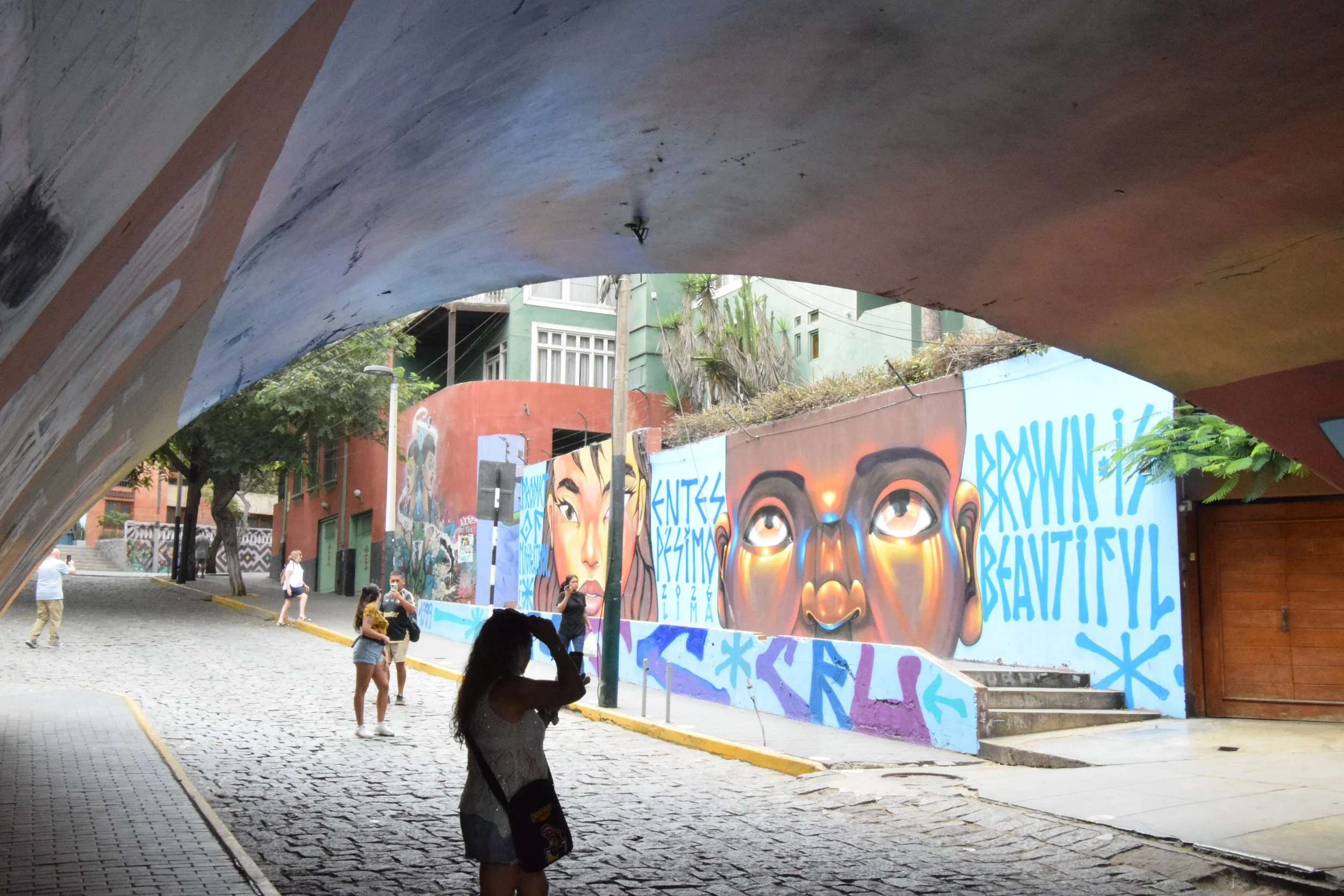
I loved Buenos Aires, and the city let me admire its charm all I wanted. I loved Lima too; it has its own charm, but it felt like Lima loved me back or at least gave me a small hug. Buenos Aires was the sexy woman, not minding you looking at her. Lima was the very pretty girl smiling because you were looking.
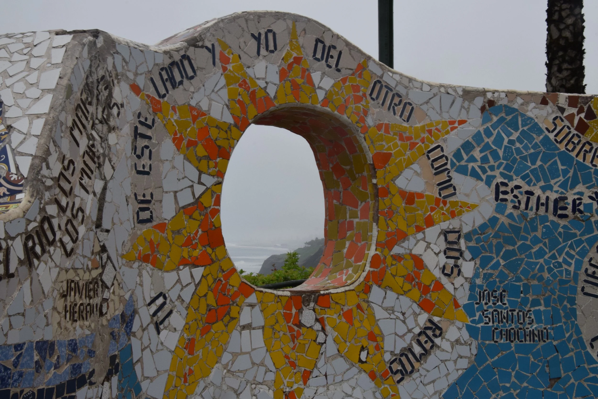
Wall decorated on a wall near the beaches of Lima, Peru
Last spring in South America, two countries taught me that place has a personality.
Argentina moved with a precise, almost European efficiency—grand, polished, and slightly reserved. Peru felt warmer, more colorful, and quietly generous, as if the country itself was glad you’d come.
I went for Patagonia’s glaciers and trails, but it was Peru that surprised me most.
I started in Buenos Aires, Argentina, but hundreds of miles from Patagonia. The city is called the Paris of South America, and it seems right. There are grand buildings with classic architecture. There are large parks and public areas that are beautiful and functional. People are out all hours of the day and night.
I was only there for a couple of days, but I felt that bright urban spirit right away. It’s a serious city that demands to be taken seriously—but it also rewards you when you do so.
There’s a European efficiency that seems to go against the usual laid-back Latin stereotype.
There is an openness, but it’s an openness to their structured system.
I stayed in Buenos Aires for two nights before my tour began. On the day I was to join the tour, I had to check out of my room, join my tour group, and check in again with the group: same hotel but a different room. Orderly, but I had to pack up and unpack again anyway. That night at an Argentine steakhouse, they brought me a liter bottle of beer. I asked if they had a smaller bottle. The waiter said no, as though it was a silly question I should not be asking.
In both instances, the system was clear and precise. They were helpful, friendly even, but there wasn’t much room to wiggle.
Patagonia was much the same. That is a very remote area, but the same spirit was there. There was a no-nonsense system in place that worked. I had no complaints, but I was always on the outside looking in.
Peru was different from the start.
I was in my hotel room for two days before the Peru part of the tour started. I asked if I would have to check out and back in. The person at the desk shrugged, “No, no you don’t have to do that,” he said. “We will take care of it.” They did take care of it, and it was that simple. I joined the tour group and stayed in the same room.
Things like that felt more normal in Peru. There was a warmth added to the efficiency that wasn’t there in Argentina.
At times it didn’t look efficient, but it still was. One time, we had to pack a few things into a small bag for a one-night stay, and then we went to another hotel. That’s a train wreck waiting to happen, but it didn’t. When we got to the next hotel the next day, we were already checked in, and our bags were waiting in our rooms.
It wasn’t a production, no formalities, just a quiet, friendly competence.
Peru was also more colorful. There were more murals, more decorated things. Argentina was beautiful, but in a more formal, historical way. Argentina felt a little more sophisticated, but Peru was friendlier and warmer.
All big cities have their street musicians. Buenos Aires had its share, and they put on performances worth stopping for. But I won't forget the older man in Lima playing a pan flute, strumming a guitar, and singing all at the same time. When I dropped a sol into his hat, he looked up, smiled, and gave me a little nod. It was a tiny gesture, but somehow it felt perfectly Peruvian.
My trip finished in Lima, Peru. I loved that city. It has 10 million people, but it didn’t feel like a big city the way Buenos Aires did. The biggest thing I noticed was the difference between how Buenos Aires and Lima felt.
I loved Buenos Aires, and the city let me admire its charm all I wanted. I loved Lima too; it has its own charm, but it felt like Lima loved me back or at least gave me a small hug. Buenos Aires was the sexy woman, not minding you looking at her. Lima was the very pretty girl smiling because you were looking.
Where is the Center of North America?
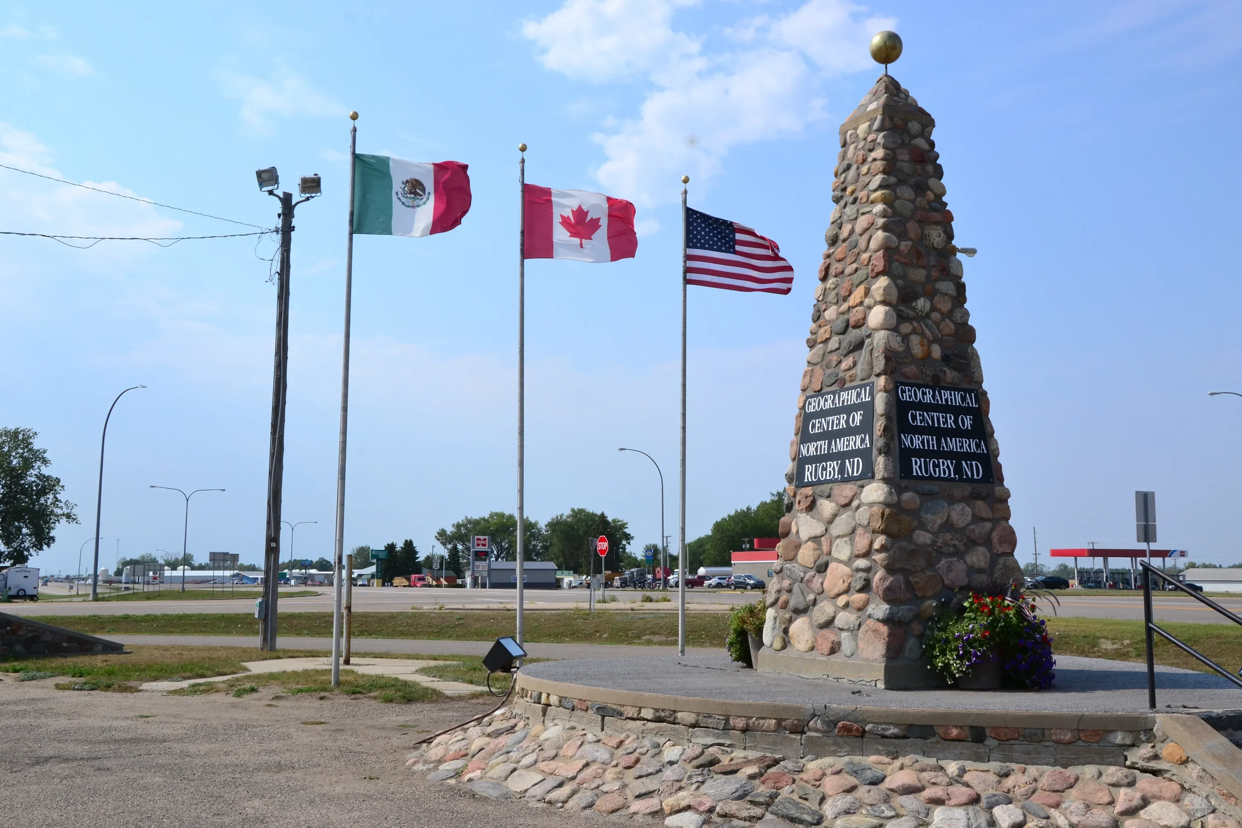
One cool thing I found was the small town of Rugby, which claims to be the geographical center of the Americans — which includes Canada and Mexico.
In 1931 the town claimed the title and erected the marker pictured above to commemorate the fact. It was based on looking at a map.
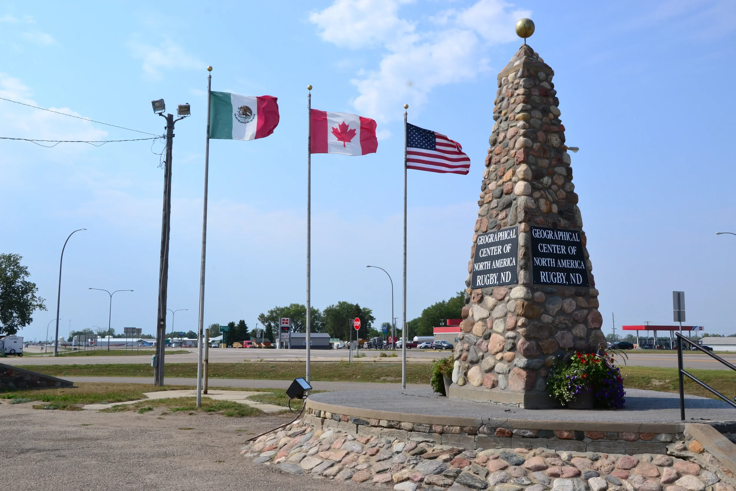
Photo by James Jordan
North Dakota is not among most people’s favorite vacation spots. It is the least visited state in the contiguous 48 states in America, according to government statistics.
So why am I taking a week or so to explore this remote state? Because it is there? Maybe.
After a couple of weeks exploring the Dakotas, there will be only eight states left for me to visit.
Admittedly, it does not have much that would make people want to visit. There are only eight cities with over 10,000 people, and the biggest city is Fargo, at 137,000. There are a lot of tiny towns in remote areas. Most of the state is flat farmland. There are the badlands in the west that have some cool scenery.
One cool thing I found was the small town of Rugby, which claims to be the geographical center of the Americas — which includes Canada and Mexico.
In 1931, the town claimed the title and erected the marker pictured above to commemorate the fact. It was based on looking at a map.
Since then, there has been some debate on where the geographical center really is, but everyone agrees it is in North Dakota.
Some time after that, the owner of a bar in Robinson, N.D. decided it was the actual center. It’s about 100 miles southwest of Rugby. The bar owner admitted to having some help from “a few beers.” But they did manage to get the title trademarked, so they did legally own the title.
Even later on, a college professor took a crack at finding the center, using a fancy algorithm he had created. He also took into consideration the curvature of the Earth, which the other two did not. His calculations declared the center to be in a town called Center, also in North Dakota.
The bar in Robinson gave the title back to Rugby, and no one it seemed, really cared about the one in Center. All is right with the world, the geographical center is back in Rugby where it claims to be.
Rugby has 2,500 people, and the other two have 500 or fewer so Rugby may be the best place for the marker.
Magic Sauce on the Inca Trail
I’m in good condition for a 69-year-old guy. Most of the people in our group were young, strong veteran trekkers who made it look easy. They were cool about it and never made me feel left behind. The Andes, however, were not as gracious. The Spanish may have conquered the Inca Empire, but even they played by the rules the mountains made.
Nothing truly prepares you for this kind of hiking. The mountains are steep beyond anything you can imagine. The air is so thin that you’re breathing in the same volume but getting almost no oxygen. It feels exactly like breathing through a straw. My guide kept reminding me to take slow, deep breaths instead of the short, panicked ones my body wanted.
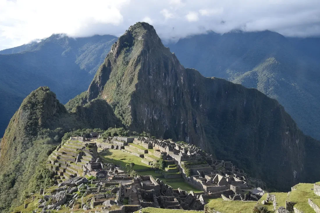
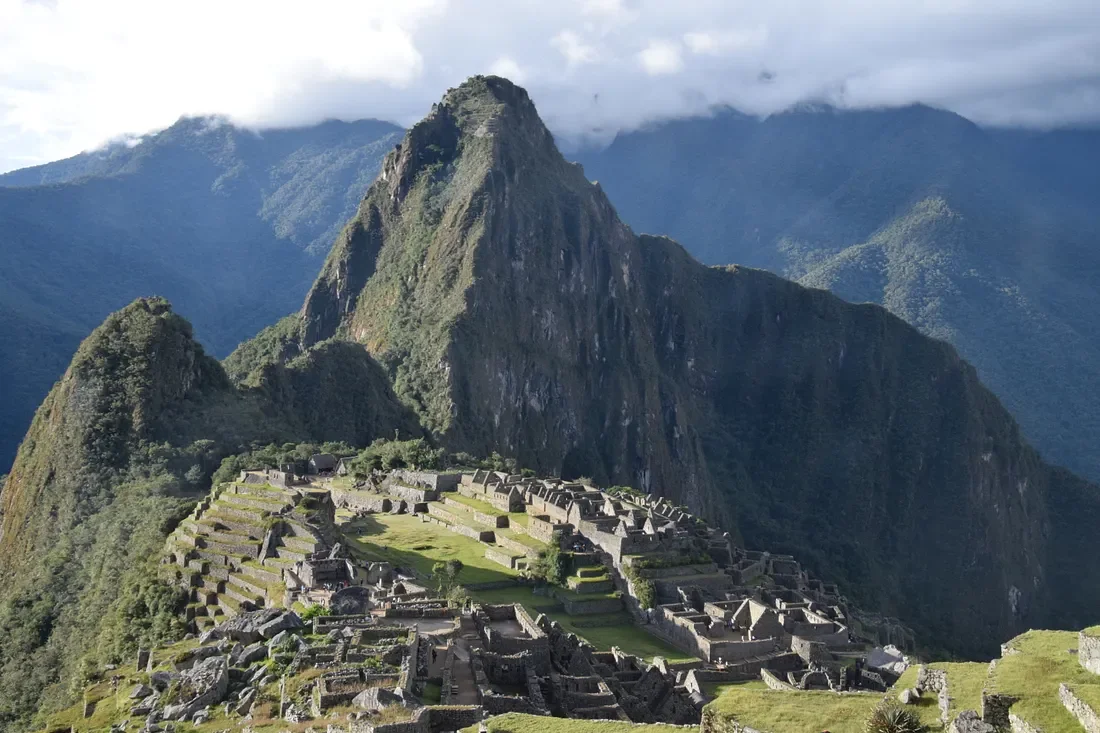
Seeing Machu Picchu from this angle, in the afternoon sun made it all worthwhile
Nothing really prepares you for the Andes Mountains, where flat is still uphill
I worked hard getting ready for my trip to Peru. I was as prepared as any human could reasonably be.
For months, I walked four or five miles a day, hiking all kinds of terrain with two gallons of water in my backpack — more weight than I’d carry on any trail in Peru. I started my anti-altitude pills three days before landing in Cusco. I stayed in the city at 11,000 feet for four full days before attempting any serious hiking. I drank coca tea and chewed coca leaves like it was my full-time religion.
I really thought I was ready for the Inca Trail — the famous 26-mile, four-day trek that ends at Machu Picchu. It’s considered one of the world’s great hikes… and also one of the hardest for a reason.
The Andes Mountains smiled — the way a mother smiles at her toddler who thinks he is helping mamma out in the kitchen. I could almost hear the spirits of the Incas sighing, “Hold my coca tea.”
Because the Andes don’t care how hard you prepared or how good of shape you think you’re in.
They took one look at me, paused for half a second… and then absolutely lost it laughing.
They laughed so hard they stole my breath on day one. They laughed so hard my balance went completely offline, and I started wobbling like a drunk toddler on the Inca Trail. They laughed so hard that even when I was gasping and stumbling, my guide felt the need to crack jokes just to keep me calm.
After one especially graceful near-miss on a narrow section, he grinned and said, “Careful, man — if you fall, you’re gonna reach the bottom of the Sacred Valley faster than anyone else!”
I couldn’t even argue. The mountains had made their point.
Press enter or click to view image in full size
The steps seemed endless along the trail. Photos by James Jordan
I’m in good condition for a 69-year-old guy. Most of the people in our group were young, strong veteran trekkers who made it look easy. They were cool about it and never made me feel left behind. The Andes, however, were not as gracious. The Spanish may have conquered the Inca Empire, but even they played by the rules the mountains made.
Nothing truly prepares you for this kind of hiking. The mountains are steep beyond anything you can imagine. The air is so thin that you’re breathing in the same volume but getting almost no oxygen. It feels exactly like breathing through a straw. My guide kept reminding me to take slow, deep breaths instead of the short, panicked ones my body wanted.
I thought my legs were strong. Back in Kansas, I could walk ten miles with short breaks. I often did four miles in an hour without a break. But Dorothy was right — I wasn’t in Kansas anymore.
Still, I marveled at everything. The trail is paved with stones that have been there for over 500 years — massive staircases carved into the mountainside. I kept picturing Inca warriors running these same paths in simple sandals or barefoot, carrying fresh fish from the coast to Cusco, while I struggled in my $400 high-tech boots.
Every climb seemed endless. You’d grind out a hundred stone steps, turn a corner, and find another hundred waiting. The Peruvians even have a joking term for the rare gentler sections: “Inca flat” — meaning “still uphill, just not quite as evil as everything else.”
The downhills were almost worse — treacherous for my shaky balance and brutal on the knees.
I was really grateful for my guide. This trip would have been much tougher alone. His gentle reminders to breathe slowly, his little jokes about me falling off the mountain — they kept me grounded and smiling through the struggle.
Press enter or click to view image in full size
Another view of Machu Picchu. Photos by James Jordan
And then there was his supply of “magic sauce.”
That’s what he called it. When I was leaning hard on my trekking poles, gasping, he came alongside me with a grin. “Time for some magic sauce.”
He pulled out a small plastic bottle, rubbed the liquid between his hands, and held them up to his face, demonstrating how to use it.
I didn’t ask any questions. I was desperate and would have done anything for some relief.
It was a powerful mix of eucalyptus, muña, and other herbs. My first inhale made me cough violently, but then… relief. My chest loosened, my head cleared, and I could actually breathe again.
About a mile later, I asked for another dose. He gave it with a knowing smile.
The magic sauce was indeed magic. It opened my airways like a cool mountain breeze and let me flow back into the trail.
It was about then that we reached the Sun Gate. From there, it was mostly downhill, and the combination of the magic sauce and the thrill of knowing we were so close gave me new energy. When I rounded the last corner and finally saw Machu Picchu spread out below me, the exhaustion vanished.
I was awestruck. Gobsmacked. A wave of pure wonder washed over me.
I had not conquered the Andes. No one does. I had surrendered to them long ago. And in return, the mountains granted me passage.
That was more than enough.
Mysterious South American Mutts
In South America, many dogs have more freedom and fewer expectations. They decide which human’s house to visit for dinner. They use people for shade. They cross busy streets like seasoned pros. They live their lives with a kind of quiet independence that I started to envy after a while.
This was the case in buenos aires, patagonia, peru, lima, cusco
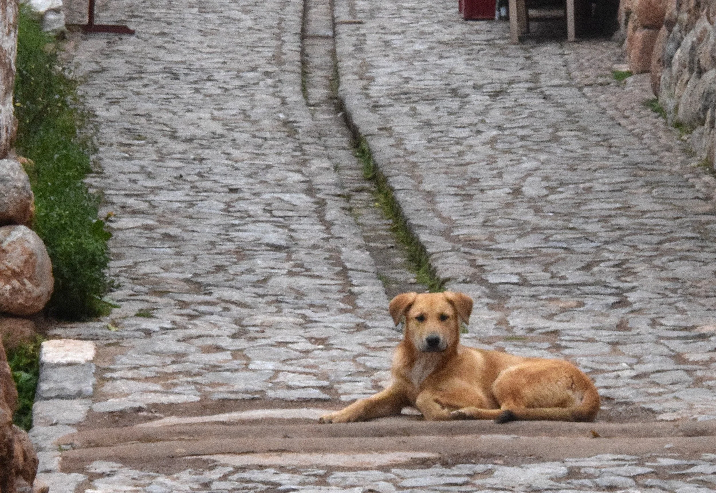
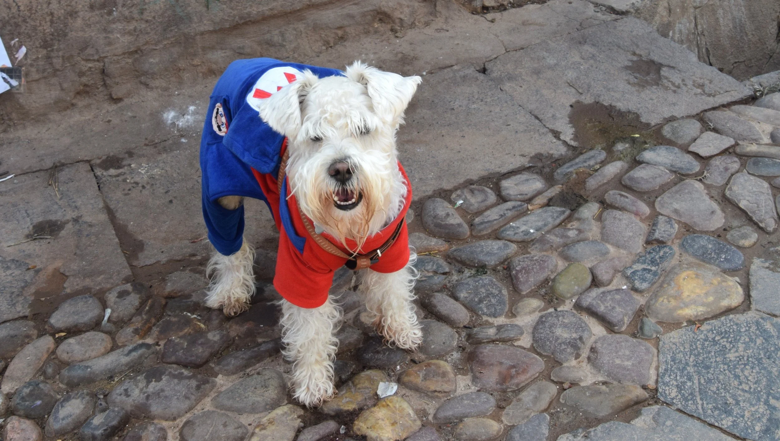
This dog was king of the street in Cusco. All photos by james jordan
What makes them so much different than our dogs?
I was sitting with our guide and a few fellow travelers in Lima, sipping cold beers after a long day on the trail. It seemed like an innocent question to me.
“So… who do all these dogs actually belong to?”
Our guide looked at me like I’d asked why water is wet. He shrugged.
“Some of them have owners… maybe?”
Then he told us about his neighbor’s dog — a scruffy, medium-sized mutt with one floppy ear. Every so often, this dog shows up at his door, scratching and whining. “I let him in and give him something to eat,” he said, completely matter-of-fact.
I joked, “So the dog is basically choosing where he wants to eat that night, just like we do?”
The guide grinned and replied, “Yeah… probably,” as if that should have been obvious too.
To South Americans, the whole situation was so normal that it was almost impossible for them to explain. They genuinely struggled to understand why I was even asking the question. It was like trying to explain air to a fish.
That one casual exchange clicked everything into place for me.
A Different Kind of Dog
I noticed it on my very first day in Buenos Aires. I stepped out of the hotel and immediately saw them — confident, streetwise dogs of every shape and size. Some were sleek and well-groomed, trotting beside their owners with perfect heel position and no leash. Others looked like classic mutts: wiry coats, battle-scarred ears, moving through the city like they had important business to attend to.
But even with dogs everywhere, not a single one seemed to notice me or anyone else.
Back home in Kansas, if a loose dog walks toward me, I feel that little spike of anxiety — Friendly? Sketchy? About to jump? In Buenos Aires, the dogs barely registered my existence. They walked around me, past me, or right beside me as though I were just another moving piece of the urban landscape. No sniffing, no tail wag, no drama. Just calm indifference.
Some dogs were clearly on their own, scavenging scraps near outdoor cafés or napping in patches of shade. Others wore collars but still wandered freely. And then there were the magic ones — dogs that walked perfectly at their person’s side with no leash, no invisible fence, nothing. I actually wondered if they had some secret high-tech collar. Turns out, no. Many porteños raise incredibly well-mannered dogs.
The street intelligence was next-level. I watched dogs walk up to a corner, pause, look both ways, and cross when it was clear. One afternoon, I saw a dog casually join a group of strangers waiting at a light. When the group stepped off the curb, so did he — using random people as his personal crossing guards. It was impressive… and a little humbling.
This is even more impressive when you realize many drivers see rules of the road as mere suggestions — not requirements. It can be tough for a human to navigate the streets.
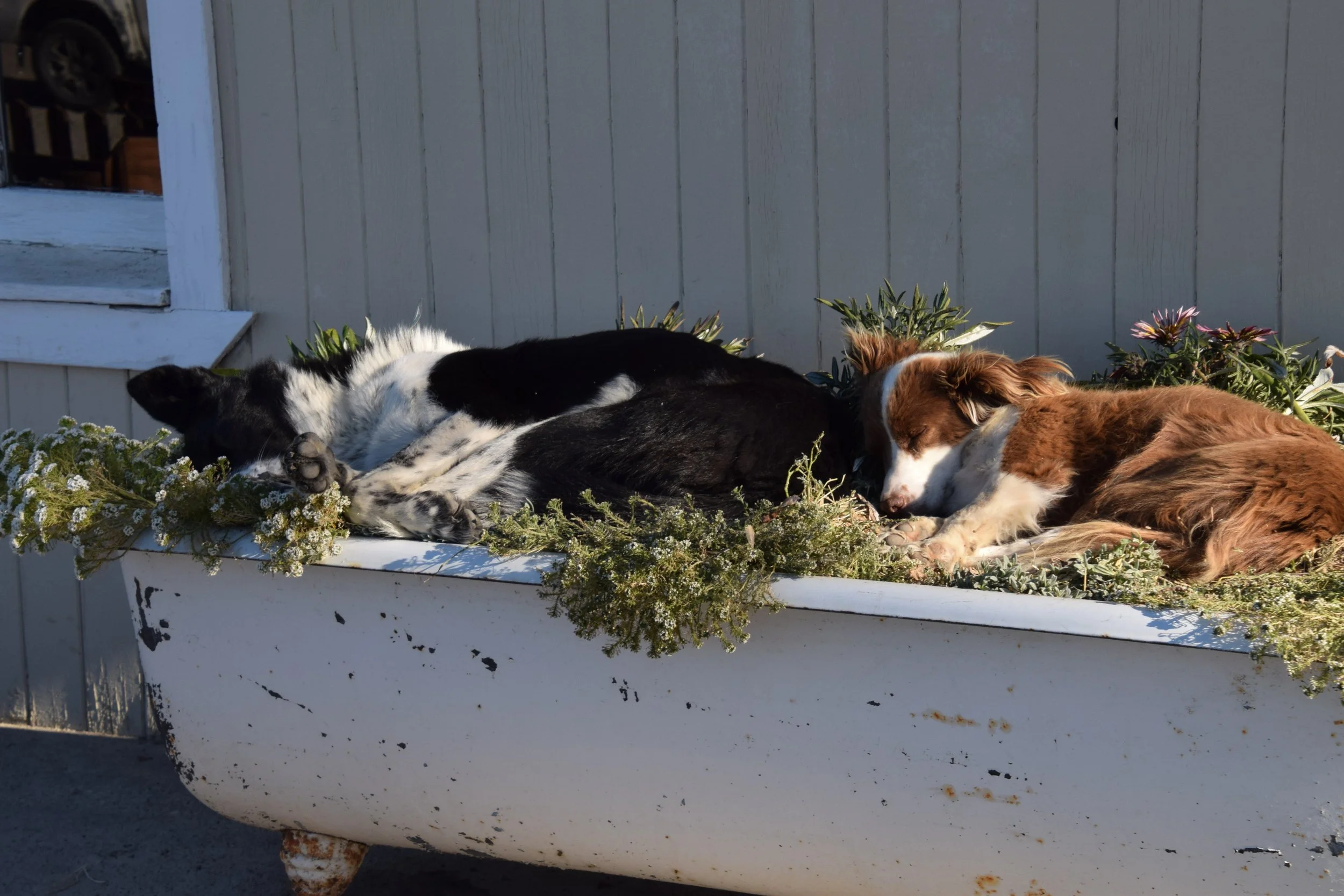
The Wild Side in Patagonia
In Patagonia, the dogs felt a bit wilder. In El Calafate, I saw a pack of five dogs explode into chaos, chasing a female in heat through the streets. It was the only time I heard a lot of barking. Even in full frenzy mode, they still dodged cars like professionals. One moment raw instinct, the next moment street-smart calm. The female seemed to have made her choice, and the other dogs dispersed.
There were also the pregnant ones — big-bellied females strolling around like it was no big deal. I saw very few puppies, though. Nature takes care of population control the hard way here.
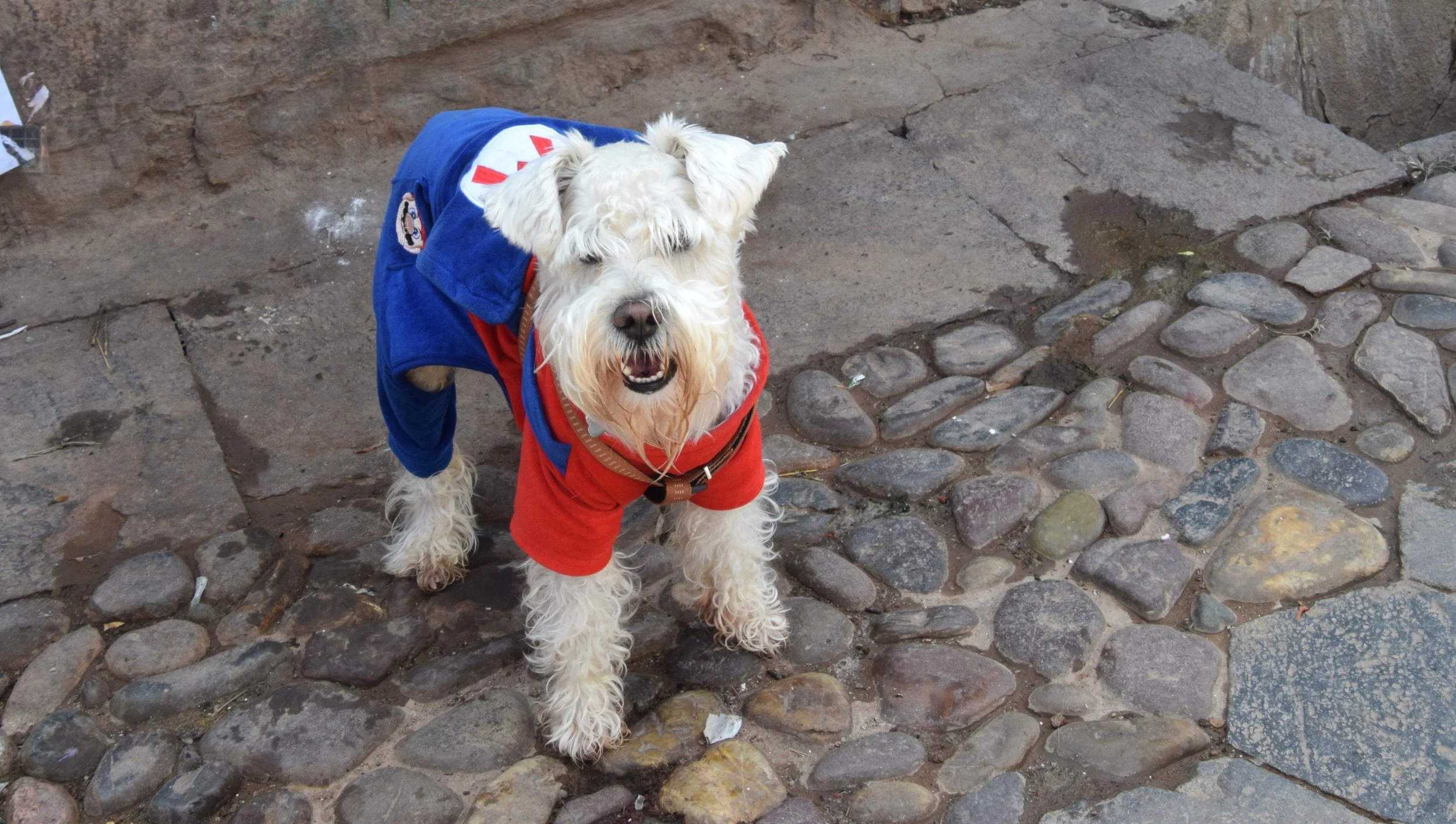
Peru’s Fashionable Dogs
Peru had its own flavor. Many dogs wore clothes — bright little sweaters and jackets to protect them from the cold Andean nights. You’d see a tough-looking street dog rocking a red coat like it was high fashion. One afternoon, while our group stood chatting in the blazing sun, a medium-sized brown mutt casually walked into the middle of our circle, flopped down in our shade, and let out a deep, satisfied sigh. He stayed for ten minutes like we were his personal umbrella, then wandered off without a backward glance.
The Middle Ground
These dogs live in a fascinating middle ground. They’re not pampered American pets who need constant attention and emotional support. But they’re also not completely wild. They’re street-smart, self-sufficient, and surprisingly comfortable sharing the world with humans — on their own terms.
In the U.S., we pour enormous love and money into our dogs. We treat them like family members. In South America, many dogs have more freedom and fewer expectations. They decide which human’s house to visit for dinner. They use people for shade. They cross busy streets like seasoned pros. They live their lives with a kind of quiet independence that I started to envy after a while.
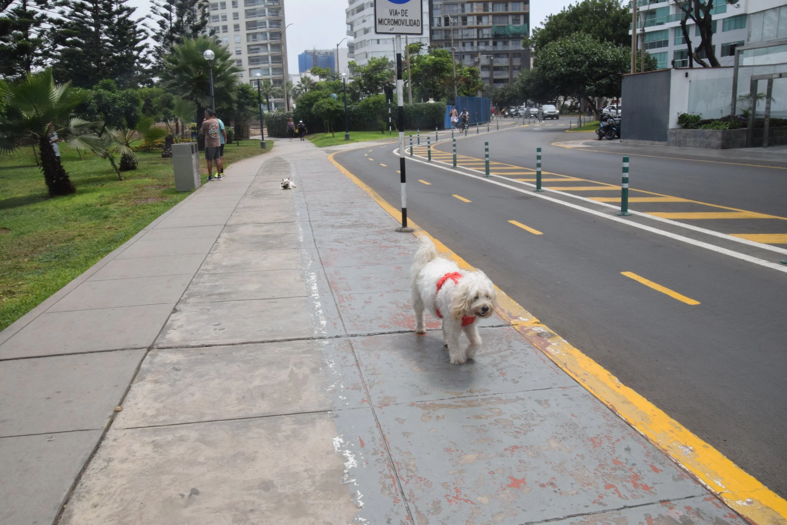
There are downsides, of course: overpopulation, parasites, shorter lifespans. But watching a dog confidently choose his dinner plans for the night, or casually join strangers for shade, made me smile.
By the end of the trip, I had grown fond of them. Not because they loved me back — they mostly didn’t care — but because they seemed so at peace with their place in the world. They weren’t waiting for someone to complete them. They were just living.
I finally understood what our guide meant. Some dogs may have owners, but many have a much less defined role. They belong to themselves more and have some friends who happen to be humans.

Screw it … Do it anyway
But one day, something occurred to me. I am going to feel like crap today, whether I go or not. If I stay in bed, I’m not going to feel better, and if I go, I’m not going to feel worse.
So I said, screw it, do it anyway. Might as well feel bad at the gym.
It worked. There were days when I went to the gym, or on a local trail, almost crying, I felt so bad. Even so, I realized I would be feeling the same way if I were at home suffering in silence. So do it anyway, I thought.
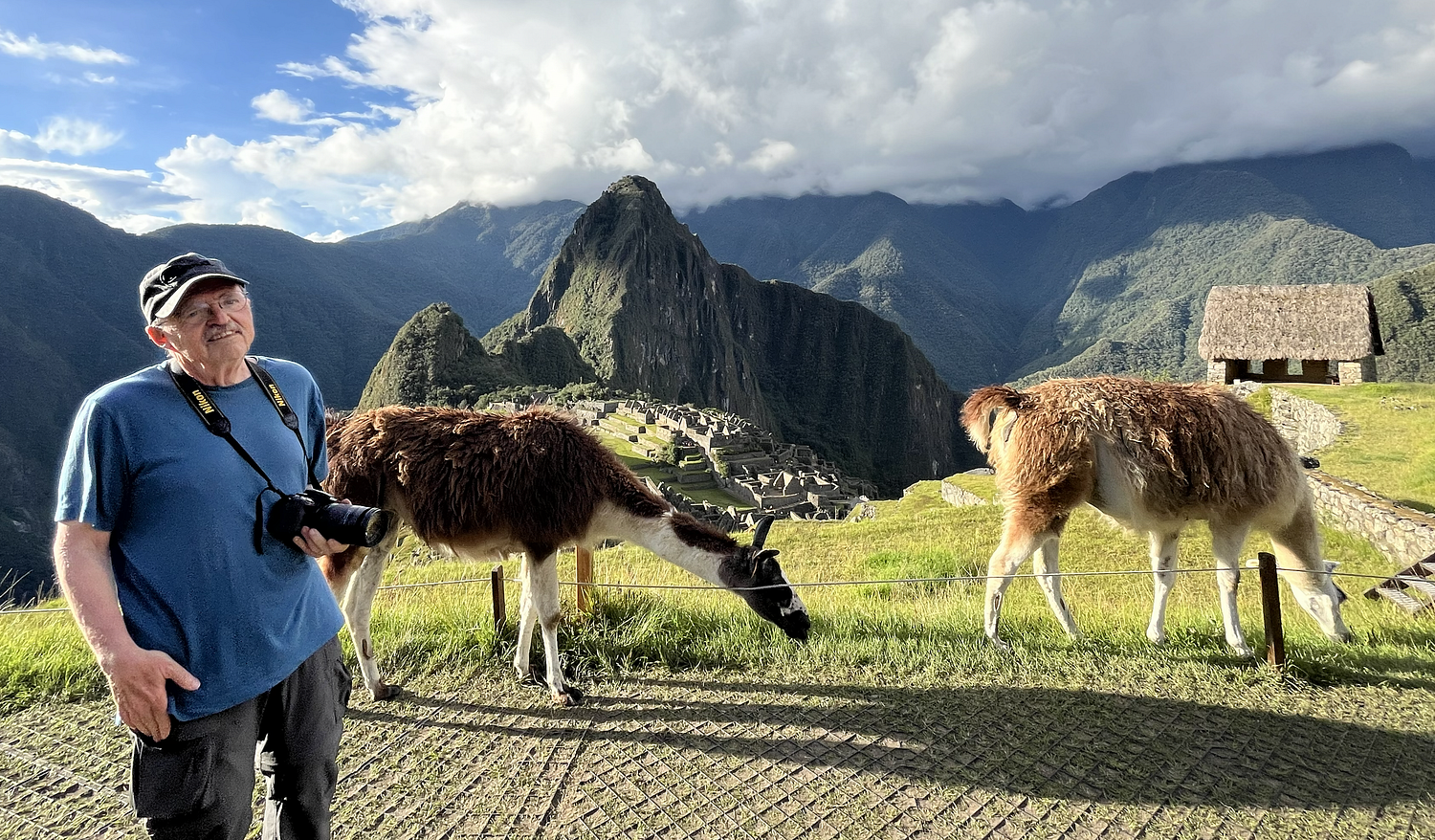
Llamas graze peacefully with Machu Picchu in the background. My battle with depression ended here at the end of the Inca Trail.
Getting ready for the Inca Trail at age 69 was my key to keeping depression under control
I have a sign on my desk that says “Do it Anyway.”
It has become my motto and battle cry since retirement, and it has worked very well.
I have struggled with depression for years, and maybe even more in retirement. It’s not the debilitating kind. Most people around me don’t even know about the struggle. Even so, it often takes a lot of effort to get up in the morning or off the couch in the afternoon.
Having said that, there’s nothing I hate more than platitude nonsense people throw at you. Easy answers that show nothing more than their ignorance.
You know the drill:
Think positive thoughts
Find a hobby
Pray harder, or more
Quit being lazy
Take this pill
Get exercise.
Any of those things can help, but none is the magic cure-all people think.
I’m not going to add to the list, but here is what happened to me when I decided to do it anyway, no matter how bad I felt.
A little more than a year ago, I decided to get serious about a bucket list trip to South America. I started out planning a hiking trip to Patagonia and ended up adding a hike up the Inca Trail in Peru.
I was going to have to do a lot of preparation. I needed to be in good physical condition. I am in good shape compared to a lot of 69-year-old men, but this was going to require much more than that.
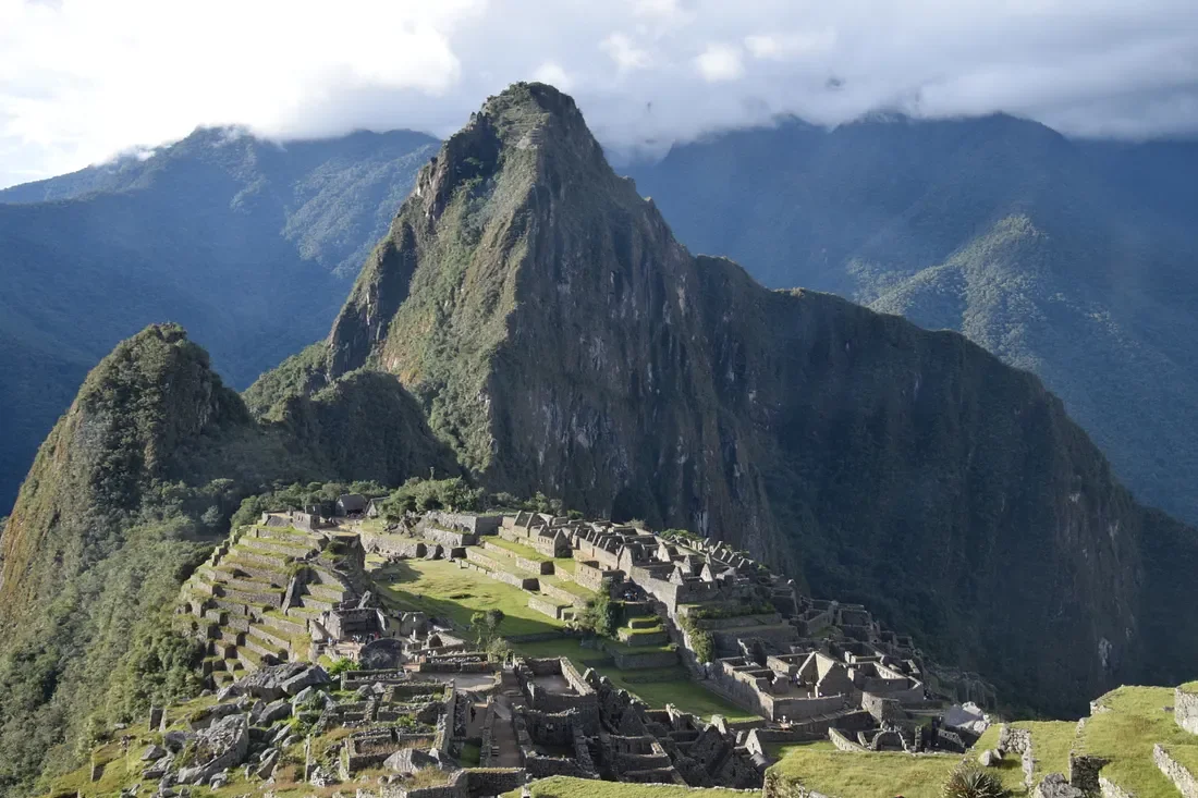
The clouds rolled back just in time to catch the evening sun on Machu Picchu
I started preparing in earnest. I went from a leisurely stroll of about two miles almost every day to about five miles a day without a day off. I worked on walking faster and started walking with a backpack of 20–30 pounds.
There are not many hills in Kansas, so I went to the local fitness center and set the treadmill on the steepest setting I could find. I got some side-eyes when I walked on the steep treadmill with a backpack of weights strapped to my back. I shrugged that off and turned the speed up.
I hiked on rough terrain when I could find it. I made two weekend trips to the Ozark Mountains in Arkansas, which offered a nice challenge.
Depression did rear its head now and then. There were days when the last thing I wanted to do was walk in cold wind with a weighted backpack on. Hell, there were days I didn’t want to even get out of bed.
But one day, something occurred to me. I am going to feel like crap today, whether I go or not. If I stay in bed, I’m not going to feel better, and if I go, I’m not going to feel worse.
So I said, screw it, do it anyway. Might as well feel bad at the gym.
It worked. There were days when I went to the gym, or on a local trail, almost crying, I felt so bad. Even so, I realized I would be feeling the same way if I were at home suffering in silence. So do it anyway, I thought.
There were also days that I felt better once I got outside. I kept going on days it didn’t, too, because … why the hell not? Not doing something isn’t going to help either.
A curmudgeon doesn’t need hope, just odds.
The thought of going to South America, and knowing I needed to be prepared, was a great incentive. But so was simply saying, do it anyway.
I did struggle a lot with depression in November and December. The return of cold weather always sends me into a tailspin that can get really dark in the middle of winter. But a strange thing happened.
I was working hard. Pushing myself relentlessly. Walking in cold wind would be good practice for Patagonia, I told myself. As I did, I noticed I felt good in the morning, which was something I didn’t even remember was possible.
By the time January rolled around, I felt like a different person. Usually, that time of year, I’m doubling up on anti-depressants, and just getting out of bed is a victory. But this time I actually had energy all day long. I was almost starting to get sociable.
By February, I was moving four or five hours a day, often with a backpack. I also started weight training — I was at the gym on the treadmill anyway.
Also in February, I realized I was not taking my pills anymore. It was not intentional, but days went by, and not taking them didn’t make much of a difference.
I went to see my doctor for a physical before my trip started, and I mentioned not taking my antidepressants lately. He shrugged and said it was fine if I didn’t feel like I needed them.
You could argue that I felt better because I had this amazing trip coming up, and that is partly right. That had a lot to do with it. But the extreme workouts were what put me over the edge. I could feel the difference when I took a day or two off. When I had even two days of not working out, I could see those dark clouds forming on the edges of my world.
By the time I was flying to Buenos Aires, I was in as good physical condition as anyone could be at my age.
The hiking was great. Even with my improved conditioning, I still went to my limits on the long hikes. The Andes mountains in Peru kicked my butt hard. I did every precaution in existence and still struggled with altitude.
I got through it, though, just out of stubbornness if nothing else.
When I got home, the depression did not return, as it often does after a big event like this. I kept working out just as hard when I got home, and I don’t see much of those clouds of darkness anymore.
This is what worked for me. There are lots of things that “can” work to get depression under control, or off your back entirely. I’m not going to offer this as a discovery that will change your world as it did mine.
This is what worked for me. Many angles and possibilities come with depression, and what works for one person may not work for another. Keep trying to find what works for you.
What do you think would happen if you just … did it anyway?